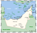
File:UAEOMCmap.png
Jump to navigation
Jump to search

Size of this preview: 671 × 599 pixels. Other resolutions: 269 × 240 pixels | 537 × 480 pixels | 928 × 829 pixels.
Original file (928 × 829 pixels, file size: 39 KB, MIME type: image/png)
File history
Click on a date/time to view the file as it appeared at that time.
| Date/Time | Thumbnail | Dimensions | User | Comment | |
|---|---|---|---|---|---|
| current | 17:54, 30 January 2021 |  | 928 × 829 (39 KB) | commons>Kelisi | The Saudi-Qatari border has been adjusted to reflect what current maps generally show. Source was Open Street Map, which I always find to be the trustworthiest in such matters (and, of course, the freest as well; so there is no copyright to worry about). |
File usage
There are no pages that use this file.