File:U.S. General Land Office Indian Territory 1879 UTA.jpg
Jump to navigation
Jump to search

Size of this preview: 743 × 599 pixels. Other resolutions: 298 × 240 pixels | 595 × 480 pixels | 952 × 768 pixels | 1,270 × 1,024 pixels | 2,540 × 2,048 pixels | 3,333 × 2,688 pixels.
Original file (3,333 × 2,688 pixels, file size: 1.43 MB, MIME type: image/jpeg)
File history
Click on a date/time to view the file as it appeared at that time.
| Date/Time | Thumbnail | Dimensions | User | Comment | |
|---|---|---|---|---|---|
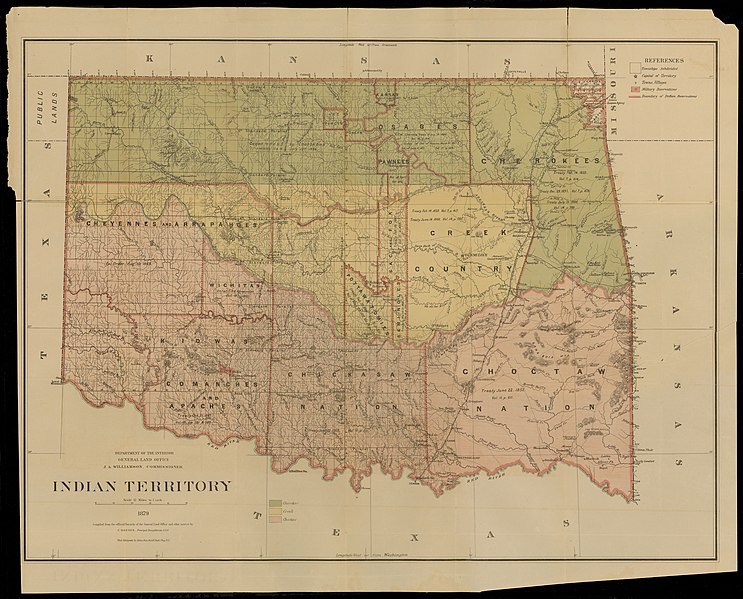
| current | 21:10, 2 April 2022 | | 3,333 × 2,688 (1.43 MB) | commons>Michael Barera | == {{int:filedesc}} == {{Map |title = {{en|'''''Indian Territory, 1879'''''}} |description = |legend = |author = United States Department of Interior |date = 1879 |source = UTA Libraries ''Cartographic Connections'': [https://libguides.uta.edu/ld.php?content_id=931883 {{I18n/map}}] / [https://libguides.uta.edu/ccon {{I18n/text}}] |permission = |map date = |location = {{Indian Territory}} |proje... |
File usage
There are no pages that use this file.