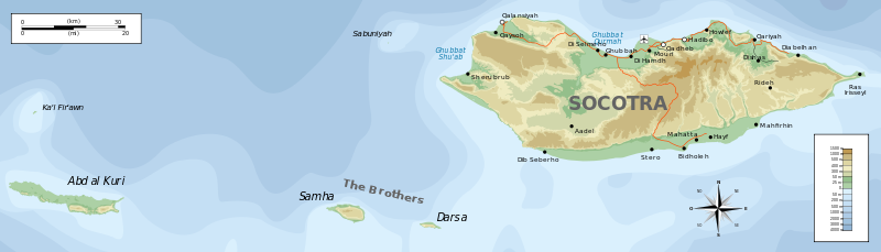
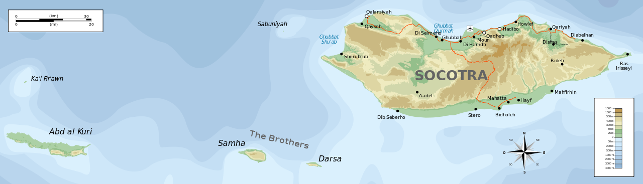
File:Topographic map of Socotra-en.svg
Jump to navigation
Jump to search

Size of this PNG preview of this SVG file: 800 × 229 pixels. Other resolutions: 320 × 92 pixels | 640 × 183 pixels | 1,024 × 293 pixels | 1,280 × 367 pixels | 2,560 × 733 pixels | 1,309 × 375 pixels.
Original file (SVG file, nominally 1,309 × 375 pixels, file size: 572 KB)
File history
Click on a date/time to view the file as it appeared at that time.
| Date/Time | Thumbnail | Dimensions | User | Comment | |
|---|---|---|---|---|---|
| current | 19:08, 29 June 2010 | 1,309 × 375 (572 KB) | commons>Mysid | removing buggy shading |
File usage
There are no pages that use this file.