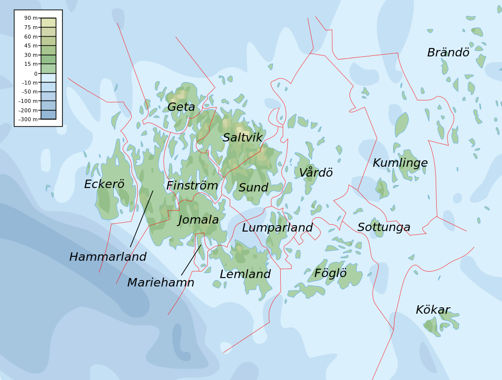
File:Topographic map of Åland.svg
Jump to navigation
Jump to search

Size of this PNG preview of this SVG file: 681 × 516 pixels. Other resolutions: 317 × 240 pixels | 634 × 480 pixels | 1,014 × 768 pixels | 1,280 × 970 pixels | 2,560 × 1,940 pixels.
Original file (SVG file, nominally 681 × 516 pixels, file size: 172 KB)
File history
Click on a date/time to view the file as it appeared at that time.
| Date/Time | Thumbnail | Dimensions | User | Comment | |
|---|---|---|---|---|---|
| current | 11:06, 12 February 2008 | | 681 × 516 (172 KB) | commons>Mysid | border wouldn't work |
File usage
There are no pages that use this file.