File:TodmordenMap1915Atlas.JPG
Jump to navigation
Jump to search

Size of this preview: 513 × 599 pixels. Other resolutions: 205 × 240 pixels | 525 × 613 pixels.
Original file (525 × 613 pixels, file size: 99 KB, MIME type: image/jpeg)
File history
Click on a date/time to view the file as it appeared at that time.
| Date/Time | Thumbnail | Dimensions | User | Comment | |
|---|---|---|---|---|---|
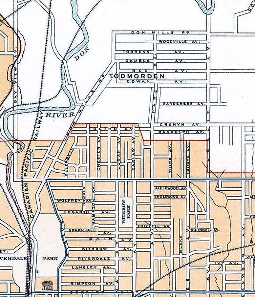
| current | 17:14, 30 August 2007 | | 525 × 613 (99 KB) | commons>Skeezix1000 | {{Information |Description=Map of Todmorden (today East York in Toronto) |Source=[http://atlas.nrcan.gc.ca/site/english/maps/archives/2ndedition 2nd Edition, 1915, Atlas of Canada] |Date=1915 |Author=Government of Canada (Department of the Interior) |Perm |
File usage
There are no pages that use this file.