File:Tiryns, map of the palace and the surrounding fortifications.png
Jump to navigation
Jump to search

Size of this preview: 800 × 481 pixels. Other resolutions: 320 × 192 pixels | 640 × 385 pixels | 872 × 524 pixels.
Original file (872 × 524 pixels, file size: 663 KB, MIME type: image/png)
File history
Click on a date/time to view the file as it appeared at that time.
| Date/Time | Thumbnail | Dimensions | User | Comment | |
|---|---|---|---|---|---|
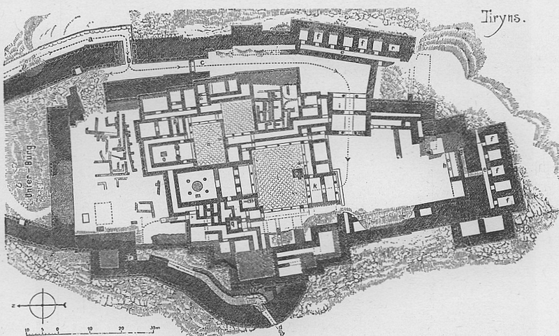
| current | 11:27, 11 June 2005 | | 872 × 524 (663 KB) | commons>Longbow4u | *'''Description''': Tiryns, Greece, map of castle *'''Author''': Albrecht Conz, scanned himself from Source, upload to German wikipedia by Albrecht Conz, 27.02.2005. *'''Source''': Gustav Ebe: |
File usage
There are no pages that use this file.