File:The Church of the Sacred Heart and St Catherine of Alexandria - geograph.org.uk - 881069.jpg
Jump to navigation
Jump to search
No higher resolution available.
The_Church_of_the_Sacred_Heart_and_St_Catherine_of_Alexandria_-_geograph.org.uk_-_881069.jpg (640 × 457 pixels, file size: 116 KB, MIME type: image/jpeg)
Summary
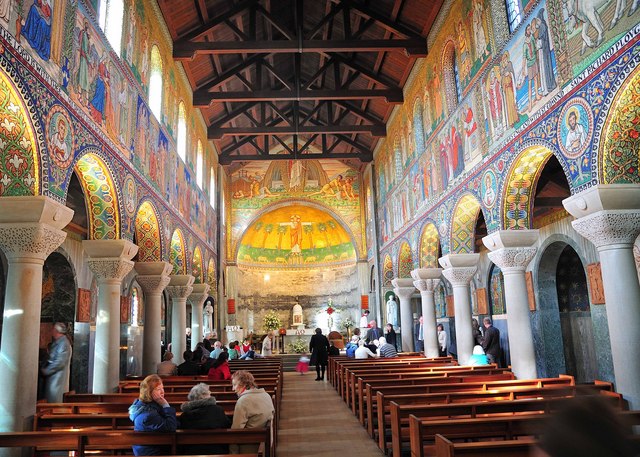
| Description |
English: Roman Catholic church of the Sacred Heart and St Catherine of Alexandria, Worcester Road, Droitwich Spa, Worcestershire: inside the nave, looking toward the apsidal chancel |
| Date | |
| Source | From geograph.org.uk; transferred by User:Magnus Manske using geograph_org2commons. |
| Author | Rod Trevaskus |
| Permission (Reusing this file) |
Creative Commons Attribution Share-alike license 2.0 |
| Camera location | | View this and other nearby images on: OpenStreetMap |
|---|
| Object location | | View this and other nearby images on: OpenStreetMap |
|---|
_region:GB-EAW_heading:315.00&language=en)
Licensing

|
This image was taken from the Geograph project collection. See this photograph's page on the Geograph website for the photographer's contact details. The copyright on this image is owned by Rod Trevaskus and is licensed for reuse under the Creative Commons Attribution-ShareAlike 2.0 license.
|
This file is licensed under the Creative Commons Attribution-Share Alike 2.0 Generic license.
Attribution: Rod Trevaskus
- You are free:
- to share – to copy, distribute and transmit the work
- to remix – to adapt the work
- Under the following conditions:
- attribution – You must give appropriate credit, provide a link to the license, and indicate if changes were made. You may do so in any reasonable manner, but not in any way that suggests the licensor endorses you or your use.
- share alike – If you remix, transform, or build upon the material, you must distribute your contributions under the same or compatible license as the original.
File history
Click on a date/time to view the file as it appeared at that time.
| Date/Time | Thumbnail | Dimensions | User | Comment | |
|---|---|---|---|---|---|
| current | 19:00, 20 July 2009 | | 640 × 457 (116 KB) | commons>File Upload Bot (Magnus Manske) | == Summary == {{Information |Description=The Church of the Sacred Heart and St Catherine of Alexandria |Source=From [http://www.geograph.org.uk/photo/881069 geograph.org.uk]; transferd by User:Magnus Manske using [http://toolserver.org/~magnus/geogra |
File usage
There are no pages that use this file.