File:Superior upland.jpg
Jump to navigation
Jump to search
No higher resolution available.
Superior_upland.jpg (400 × 302 pixels, file size: 40 KB, MIME type: image/jpeg)
Summary
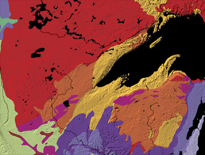
Geological map of the Superior Upland region in the United States. Lake waters are shown as black.
Source: The Superior Upland archive copy at the Wayback Machine, The North American Tapestry of Time and Terrain, National Atlas of the United States.
Licensing
This work is in the public domain in the United States because it is a work prepared by an officer or employee of the United States Government as part of that person’s official duties under the terms of Title 17, Chapter 1, Section 105 of the US Code.
Note: This only applies to original works of the Federal Government and not to the work of any individual U.S. state, territory, commonwealth, county, municipality, or any other subdivision. This template also does not apply to postage stamp designs published by the United States Postal Service since 1978. (See § 313.6(C)(1) of Compendium of U.S. Copyright Office Practices). It also does not apply to certain US coins; see The US Mint Terms of Use.
|
 | |
| This file has been identified as being free of known restrictions under copyright law, including all related and neighboring rights. | ||
File history
Click on a date/time to view the file as it appeared at that time.
| Date/Time | Thumbnail | Dimensions | User | Comment | |
|---|---|---|---|---|---|
| current | 03:27, 15 June 2007 | | 400 × 302 (40 KB) | commons>Avenue |
File usage
There are no pages that use this file.