File:Strait tiran 83.jpg
Jump to navigation
Jump to search
Size of this preview: 472 × 599 pixels. Other resolutions: 189 × 240 pixels | 378 × 480 pixels | 996 × 1,264 pixels.
Original file (996 × 1,264 pixels, file size: 198 KB, MIME type: image/jpeg)
| Description |
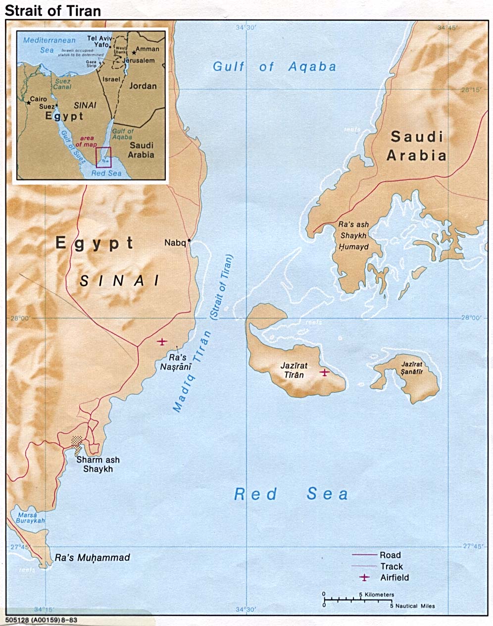
English: Strait of Tiran between Gulf of Aqaba and Red Sea |
|||
| Date | ||||
| Source | http://www.lib.utexas.edu/maps/middle_east_and_asia/strait_tiran_83.jpg | |||
| Author | "The following maps were produced by the U.S. Central Intelligence Agency, unless otherwise indicated." | |||
| Permission (Reusing this file) |
|
|||
| Other versions | العربيَّة |

File history
Click on a date/time to view the file as it appeared at that time.
| Date/Time | Thumbnail | Dimensions | User | Comment | |
|---|---|---|---|---|---|
| current | 16:46, 23 February 2007 | | 996 × 1,264 (198 KB) | commons>Monack | {{Information |Description = {{en|Strait of Tiran between Gulf of Aqaba and Red Sea}} |Source = http://www.lib.utexas.edu/maps/middle_east_and_asia/strait_tiran_83.jpg |Date = 1983 |Author = "The following maps were produced by the U.S. Central Intellige |
File usage
There are no pages that use this file.