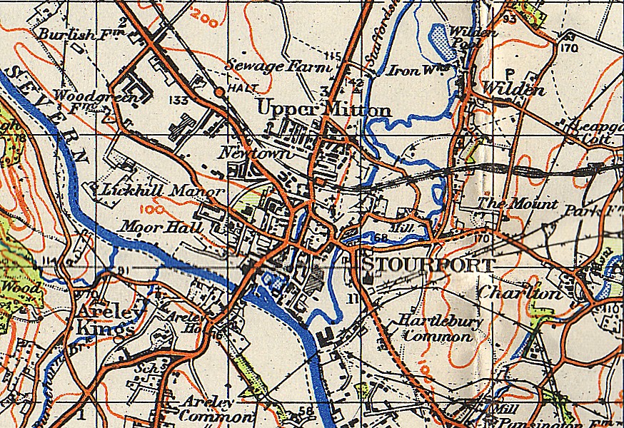
File:Stourport-on-Severn OS map 1942.jpg
Jump to navigation
Jump to search
Size of this preview: 800 × 549 pixels. Other resolutions: 320 × 220 pixels | 640 × 439 pixels.
Original file (874 × 600 pixels, file size: 373 KB, MIME type: image/jpeg)
File history
Click on a date/time to view the file as it appeared at that time.
| Date/Time | Thumbnail | Dimensions | User | Comment | |
|---|---|---|---|---|---|
| current | 23:23, 10 May 2007 | | 874 × 600 (373 KB) | commons>Loganberry~commonswiki | {{Information |Description=w:Stourport-on-Severn and surrounding area |Source=w:Ordnance Survey map one-inch sheet 71 (Second War Revision 1940) entitled "Kidderminster" |Date=1942 |Author=Map by w:Ordnance Survey; scan by User:Loganberry |
File usage
There are no pages that use this file.