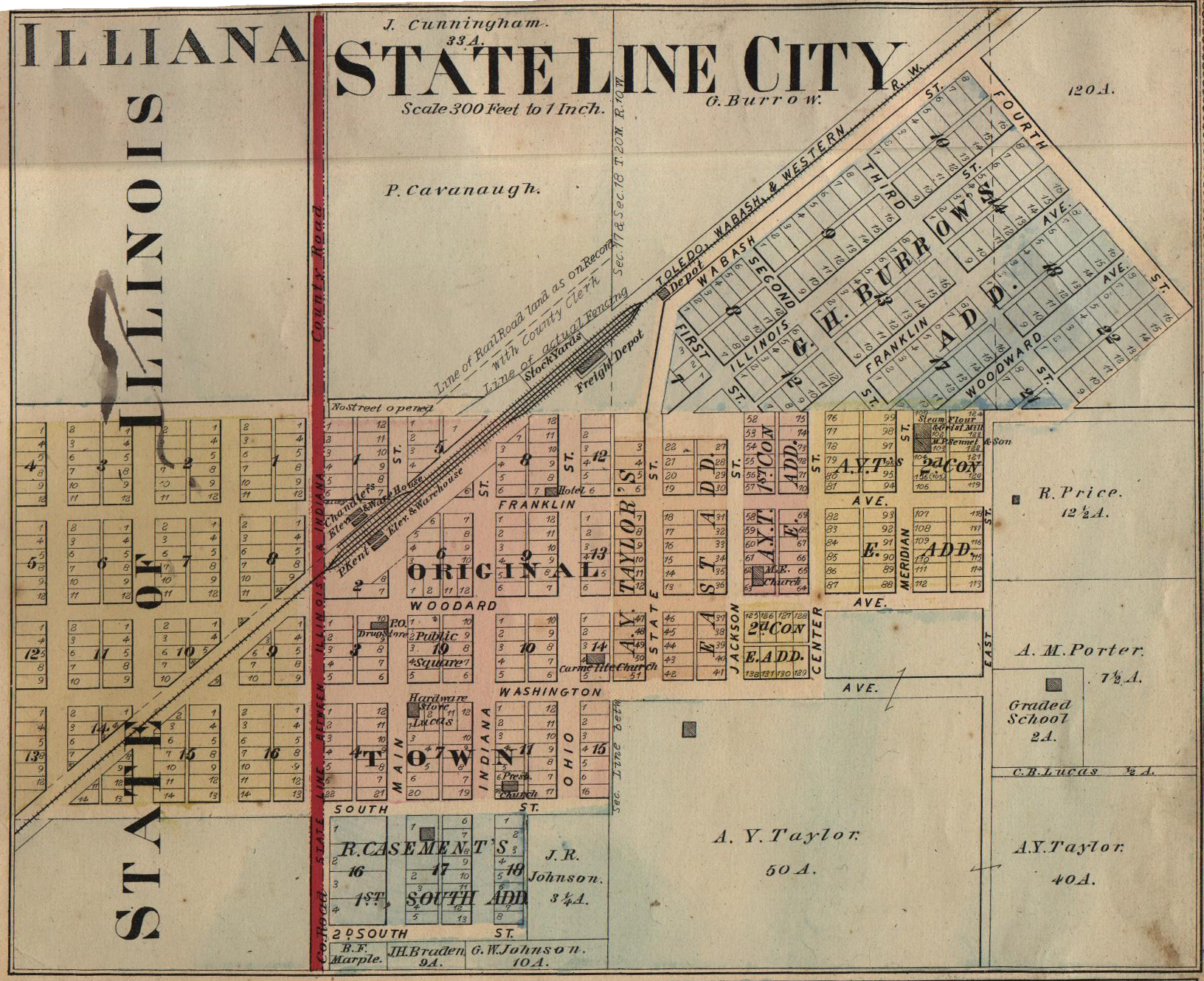
File:State Line City Indiana map from 1877 atlas.png
Jump to navigation
Jump to search
Size of this preview: 736 × 600 pixels. Other resolutions: 295 × 240 pixels | 589 × 480 pixels | 943 × 768 pixels | 1,257 × 1,024 pixels | 1,632 × 1,330 pixels.
Original file (1,632 × 1,330 pixels, file size: 3.74 MB, MIME type: image/png)
File history
Click on a date/time to view the file as it appeared at that time.
| Date/Time | Thumbnail | Dimensions | User | Comment | |
|---|---|---|---|---|---|
| current | 17:28, 18 October 2008 | | 1,632 × 1,330 (3.74 MB) | commons>Omnedon | == Summary == {{Information |Description=A map of the town of State Line City, Indiana |Source=Atlas of Warren County, Indiana |Date=1877 |Author=J. H. Beers and Company, Chicago |Permission= |other_versions= }} {{overlay} |
File usage
There are no pages that use this file.