File:South East England - East Surrey constituency.svg
Jump to navigation
Jump to search

Size of this PNG preview of this SVG file: 785 × 599 pixels. Other resolutions: 314 × 240 pixels | 629 × 480 pixels | 1,006 × 768 pixels | 1,280 × 977 pixels | 2,560 × 1,955 pixels | 1,239 × 946 pixels.
Original file (SVG file, nominally 1,239 × 946 pixels, file size: 763 KB)
Summary
| Description |
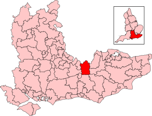
English: Boundary of East Surrey in South East England |
| Date | |
| Source | https://osdatahub.os.uk/downloads/open/BoundaryLine |
| Author | Mirrorme22, created using Ordnance Survey data. |
Licensing
This file is licensed under the Creative Commons Attribution-Share Alike 3.0 Unported license.
Attribution: Contains Ordnance Survey data © Crown copyright and database right
- You are free:
- to share – to copy, distribute and transmit the work
- to remix – to adapt the work
- Under the following conditions:
- attribution – You must give appropriate credit, provide a link to the license, and indicate if changes were made. You may do so in any reasonable manner, but not in any way that suggests the licensor endorses you or your use.
- share alike – If you remix, transform, or build upon the material, you must distribute your contributions under the same or compatible license as the original.
File history
Click on a date/time to view the file as it appeared at that time.
| Date/Time | Thumbnail | Dimensions | User | Comment | |
|---|---|---|---|---|---|
| current | 10:09, 11 June 2024 | | 1,239 × 946 (763 KB) | commons>Mirrorme22 | Uploaded a work by Mirrorme22, created using Ordnance Survey data. from https://osdatahub.os.uk/downloads/open/BoundaryLine with UploadWizard |
File usage
There are no pages that use this file.