File:South America laea relief location map.jpg
Jump to navigation
Jump to search

Size of this preview: 409 × 600 pixels. Other resolutions: 163 × 240 pixels | 327 × 480 pixels | 524 × 768 pixels | 1,181 × 1,732 pixels.
Original file (1,181 × 1,732 pixels, file size: 1.71 MB, MIME type: image/jpeg)
File history
Click on a date/time to view the file as it appeared at that time.
| Date/Time | Thumbnail | Dimensions | User | Comment | |
|---|---|---|---|---|---|
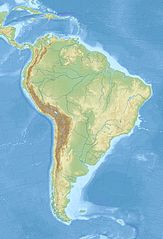
| current | 12:50, 27 November 2010 | | 1,181 × 1,732 (1.71 MB) | commons>Uwe Dedering | {{Information |Description={{en|1= Relief location map of SouthAmerica. * Projection: Lambert azimuthal equal-area projection. * Area of interest: :* N: 25.0° N :* S: -60.0° N :* W: -90.0° E :* E: -30.0° E * Projection center: :* NS: -17.5° N :* WE: |
File usage
There are no pages that use this file.