File:Skagitrivermap.png
Jump to navigation
Jump to search
No higher resolution available.
Skagitrivermap.png (500 × 500 pixels, file size: 353 KB, MIME type: image/png)
File history
Click on a date/time to view the file as it appeared at that time.
| Date/Time | Thumbnail | Dimensions | User | Comment | |
|---|---|---|---|---|---|
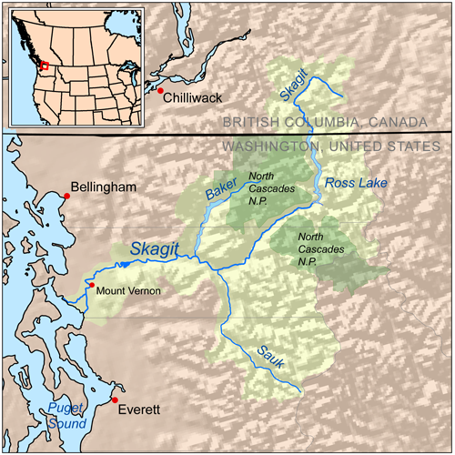
| current | 19:11, 7 August 2008 | | 500 × 500 (353 KB) | commons>Kmusser | == Summary == {{Information |Description=Map showing the Skagit River drainage basin. |Source=Self-made, based on National Atlas, GeoBase and [[:en:GTOPO30|GTOP |
File usage
There are no pages that use this file.