File:Siachen Glacier Satellite Image, 1.jpg
Jump to navigation
Jump to search

Size of this preview: 648 × 600 pixels. Other resolutions: 259 × 240 pixels | 519 × 480 pixels | 713 × 660 pixels.
Original file (713 × 660 pixels, file size: 271 KB, MIME type: image/jpeg)
File history
Click on a date/time to view the file as it appeared at that time.
| Date/Time | Thumbnail | Dimensions | User | Comment | |
|---|---|---|---|---|---|
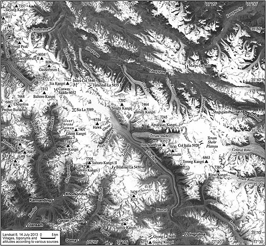
| current | 03:33, 10 September 2020 | | 713 × 660 (271 KB) | commons>Zeex.rice | {{subst:Upload marker added by en.wp UW}} {{Information |Description = {{en|A satellite image showing an overhead view of the terrain in the Siachen glacier region of Kashmir.}} |Source = https://www.sciencedirect.com/science/article/pii/S0962629815000347 |Date = September 2015 |Author = Ravi Baghel, Marcus Nüsser |Permission = https://creativecommons.org/licenses/by-nc-nd/4.0/ }} ;Other information: {{en|The authors also explicitly state that this work is "Under a Creative Commons license"... |
File usage
There are no pages that use this file.