File:Seattle - Loyal Heights map.jpg
Jump to navigation
Jump to search
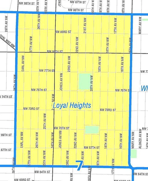
Size of this preview: 491 × 600 pixels. Other resolutions: 196 × 240 pixels | 393 × 480 pixels | 642 × 784 pixels.
Original file (642 × 784 pixels, file size: 89 KB, MIME type: image/jpeg)
File history
Click on a date/time to view the file as it appeared at that time.
| Date/Time | Thumbnail | Dimensions | User | Comment | |
|---|---|---|---|---|---|
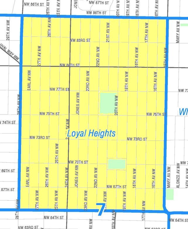
| current | 05:55, 27 April 2011 | | 642 × 784 (89 KB) | commons>Jmabel | == {{int:filedesc}} == {{Information |Description={{en|Map of the Loyal Heights portion of Seattle's Ballard neighborhood. Like the other maps from the Seattle City Clerk's Neighborhood Map Atlas, this is ''not'' an official map; in particular, borders ar |
File usage
There are no pages that use this file.