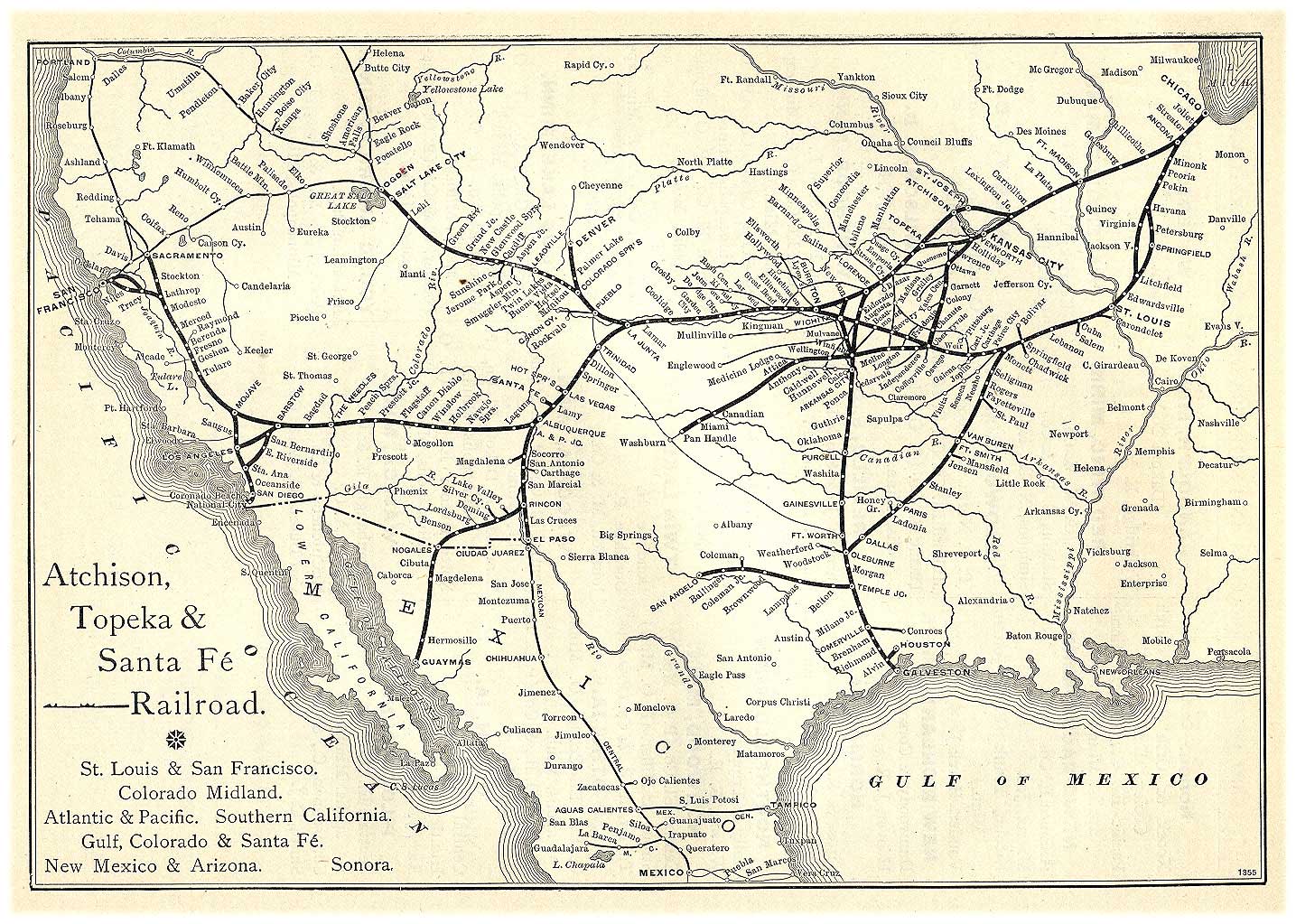
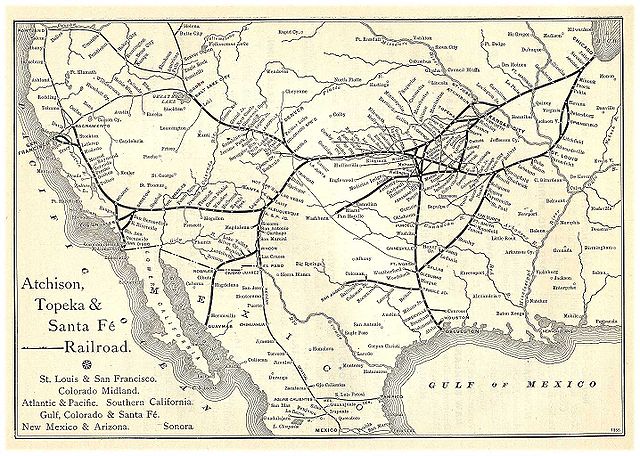
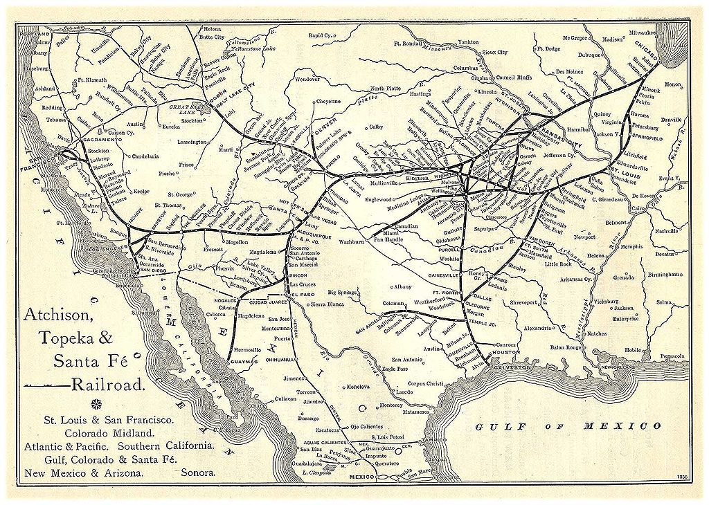
File:Santa Fe Route Map 1891.jpg
Jump to navigation
Jump to search
Size of this preview: 800 × 570 pixels. Other resolutions: 320 × 228 pixels | 640 × 456 pixels | 1,024 × 730 pixels | 1,435 × 1,023 pixels.
Original file (1,435 × 1,023 pixels, file size: 355 KB, MIME type: image/jpeg)
File history
Click on a date/time to view the file as it appeared at that time.
| Date/Time | Thumbnail | Dimensions | User | Comment | |
|---|---|---|---|---|---|
| current | 20:38, 24 December 2007 | | 1,435 × 1,023 (355 KB) | commons>Jmabel | {{Information |Description={{en|An Atchison, Topeka & Santa Fe Railway Route Map from the 1891 (title ''Grain Dealers and Shippers Gazetteer''. en:Category:Atchison, Topeka and Santa Fe Railway images [[:en:Category:Historical maps of the United St |
File usage
There are no pages that use this file.