File:Sanson Amerique Septentrionale 1650 UTA.jpg
Jump to navigation
Jump to search

Size of this preview: 800 × 561 pixels. Other resolutions: 320 × 224 pixels | 640 × 448 pixels | 1,024 × 718 pixels | 1,280 × 897 pixels | 2,560 × 1,794 pixels | 3,836 × 2,688 pixels.
Original file (3,836 × 2,688 pixels, file size: 1.89 MB, MIME type: image/jpeg)
File history
Click on a date/time to view the file as it appeared at that time.
| Date/Time | Thumbnail | Dimensions | User | Comment | |
|---|---|---|---|---|---|
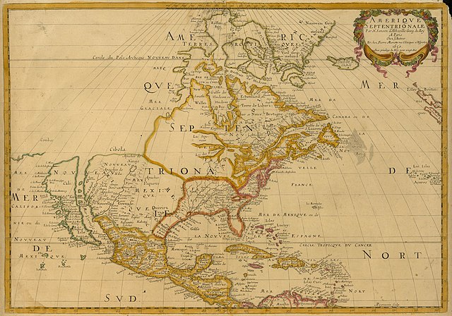
| current | 15:27, 8 February 2022 | | 3,836 × 2,688 (1.89 MB) | commons>Michael Barera | == {{int:filedesc}} == {{Map |title = {{la|'''''Amerique Septentrionale'''''}} |description = {{en|Sanson's landmark 1650 map of North America includes interesting details relating to chartered company operations in the northern and eastern part of the continent as well as the Caribbean. Employing a sinusoidal projection, its construction demonstrates considerable scientific acumen. Much of the Great Lakes system now appears, with Lakes Superior and Ontario named for the f... |
File usage
There are no pages that use this file.