File:San Gabriel river map.png
Jump to navigation
Jump to search
Size of this preview: 616 × 600 pixels. Other resolutions: 246 × 240 pixels | 493 × 480 pixels | 788 × 768 pixels | 1,155 × 1,125 pixels.
Original file (1,155 × 1,125 pixels, file size: 894 KB, MIME type: image/png)
File history
Click on a date/time to view the file as it appeared at that time.
| Date/Time | Thumbnail | Dimensions | User | Comment | |
|---|---|---|---|---|---|
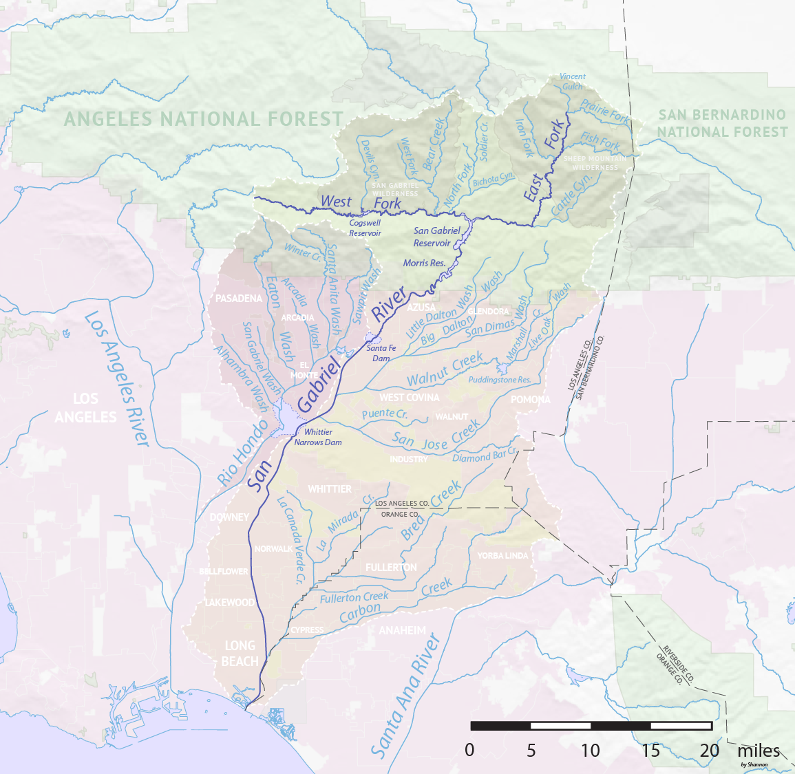
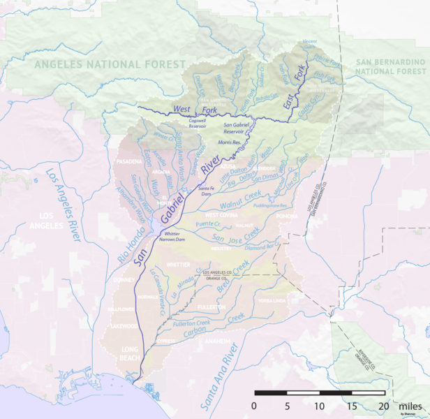
| current | 00:23, 24 August 2017 | | 1,155 × 1,125 (894 KB) | commons>Shannon1 | {{Information |Description ={{en|1=Map of the San Gabriel River watershed in the Greater Los Angeles Area, California. Made using public domain Natural Earth and U.S. Geological Survey data.}} |Source =Own work |Author =[[User:Shanno... |
File usage
There are no pages that use this file.