File:Saint-Barthélemy quartiers map.svg
From WikiProjectMed
Jump to navigation
Jump to search
Size of this PNG preview of this SVG file: 800 × 536 pixels. Other resolutions: 320 × 215 pixels | 640 × 429 pixels | 1,024 × 687 pixels | 1,280 × 858 pixels | 2,560 × 1,717 pixels | 1,275 × 855 pixels.
Original file (SVG file, nominally 1,275 × 855 pixels, file size: 153 KB)
This file is from a shared repository and may be used by other projects. The description on its file description page there is shown below.
Paroisse Sous le Vent | Paroisse Au Vent | ||
---|---|---|---|
Number on map | Quartier | Number on map | Quartier |
1 2 3 4 5 6 7 8 9 10 11 12 13 14 15 16 17 18 19 20 |
Colombier Flamands Terre Neuve Grande Vigie Corossol Merlette La Grande Montagne Anse des Lézards Anse des Cayes Le Palidor Public Col de la Tourmente Quartier du Roi Le Château Aéroport Saint-Jean Gustavia La Pointe Lurin Carénage |
21 22 23 24 25 26 27 28 29 30 31 32 33 34 35 36 37 38 39 40 |
Morne Criquet Morne de Dépoudré Gouverneur Anse du Gouverneur? Morne Rouge Grande Saline Petite Saline Lorient Barrière des Quatres Vents Camaruche Grand Fond Toiny Devet Vitet Grand Cul-de-Sac Pointe Milou Mont Jean Marigot Anse du Grand Cul-de-Sac? Petit Cul-de-Sac |
Summary
Camera location | 17° 54′ 00″ N, 62° 50′ 00″ W | View this and other nearby images on: OpenStreetMap | 17.900000; -62.833333 |
---|
Licensing
Eric Gaba, Wikimedia Commons user Sting, the copyright holder of this work, hereby publishes it under the following license:
This file is licensed under the Creative Commons Attribution-Share Alike 3.0 Unported license.
Attribution: Eric Gaba, Wikimedia Commons user Sting
- You are free:
- to share – to copy, distribute and transmit the work
- to remix – to adapt the work
- Under the following conditions:
- attribution – You must give appropriate credit, provide a link to the license, and indicate if changes were made. You may do so in any reasonable manner, but not in any way that suggests the licensor endorses you or your use.
- share alike – If you remix, transform, or build upon the material, you must distribute your contributions under the same or compatible license as the original.
Items portrayed in this file
depicts
July 2010
17°54'0.000"N, 62°49'59.999"W
File history
Click on a date/time to view the file as it appeared at that time.
Date/Time | Thumbnail | Dimensions | User | Comment | |
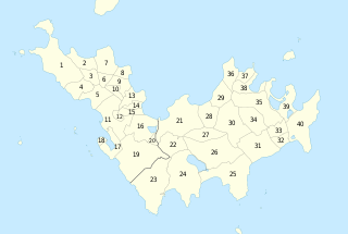
---|---|---|---|---|---|
current | 19:04, 23 July 2010 | 1,275 × 855 (153 KB) | commons>Sting | {| width="600px" border="1" align="center" cellpadding="5" |- bgcolor="#FEF6D2" | ! colspan="2" width="50%" | Paroisse Sous le Vent ! colspan="2" | Paroisse Au Vent |- bgcolor="#F7F7F7" | ! width="15%" | Number on map !! Quartier !! width="15%" | Number |
File usage
There are no pages that use this file.
Metadata
This file contains additional information, probably added from the digital camera or scanner used to create or digitize it.
If the file has been modified from its original state, some details may not fully reflect the modified file.
Short title | Numbered map of the quartiers and parishes of Saint Barthélemy island, France |
---|
Retrieved from "https://mdwiki.org/wiki/File:Saint-Barthélemy_quartiers_map.svg"