File:SAR Map.jpg
Jump to navigation
Jump to search

Size of this preview: 793 × 600 pixels. Other resolutions: 318 × 240 pixels | 635 × 480 pixels | 1,016 × 768 pixels | 1,230 × 930 pixels.
Original file (1,230 × 930 pixels, file size: 570 KB, MIME type: image/jpeg)
File history
Click on a date/time to view the file as it appeared at that time.
| Date/Time | Thumbnail | Dimensions | User | Comment | |
|---|---|---|---|---|---|
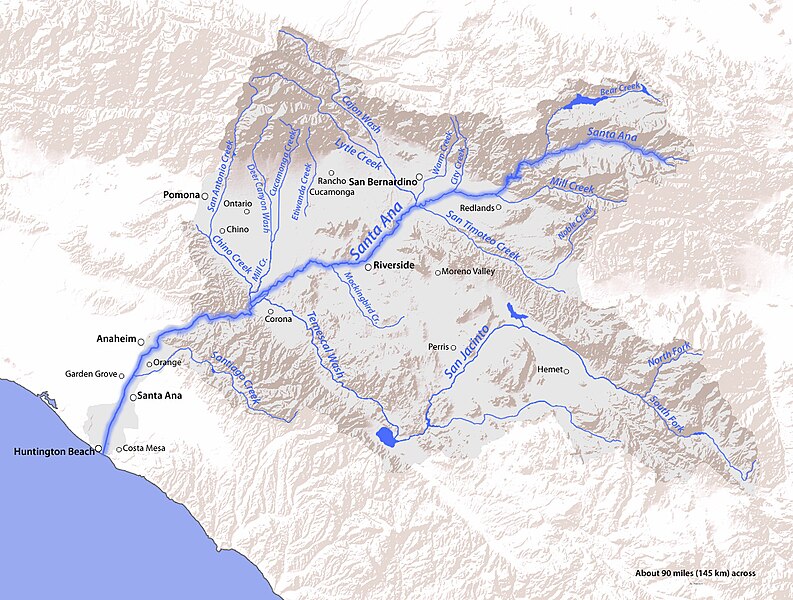
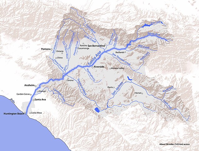
| current | 23:25, 20 May 2011 | | 1,230 × 930 (570 KB) | commons>Shannon1 | {{Information |Description ={{en|1=Map of the Santa Ana River watershed in southern California, USA}} |Source =Topography from USGS, rest by me |Author =Shannon1 |Date =2011-05-20 |Permission = |other_ver |
File usage
There are no pages that use this file.