File:Ras Doumeira.png
Jump to navigation
Jump to search

Size of this preview: 800 × 461 pixels. Other resolutions: 320 × 184 pixels | 640 × 369 pixels | 1,147 × 661 pixels.
Original file (1,147 × 661 pixels, file size: 70 KB, MIME type: image/png)
File history
Click on a date/time to view the file as it appeared at that time.
| Date/Time | Thumbnail | Dimensions | User | Comment | |
|---|---|---|---|---|---|
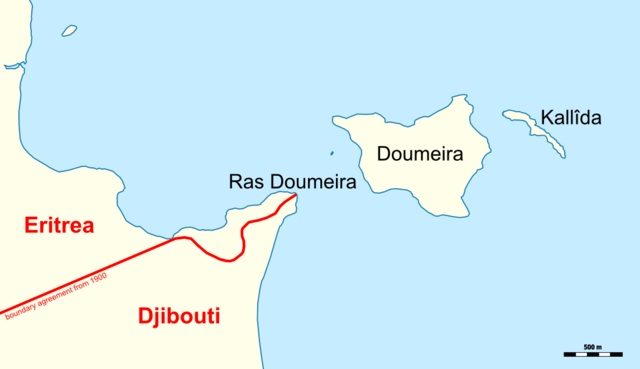
| current | 20:33, 28 October 2014 | | 1,147 × 661 (70 KB) | commons>Archer90 | {{Information |Description={{en|Map showing the disputed territory of Cape Ras Doumeira and Doumeira Islands}} {{de|Karte des umstrittenen Gebietes Kap Ras Doumeira und Doumeira-Inseln}} |Source=own work, using * OpenStreetMap data for the backgrou... |
File usage
There are no pages that use this file.