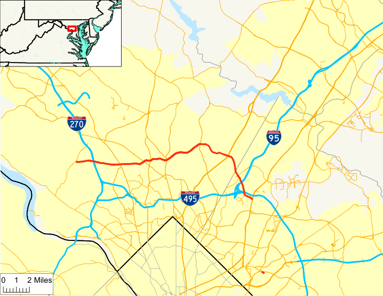
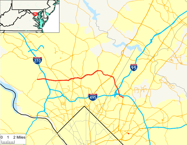
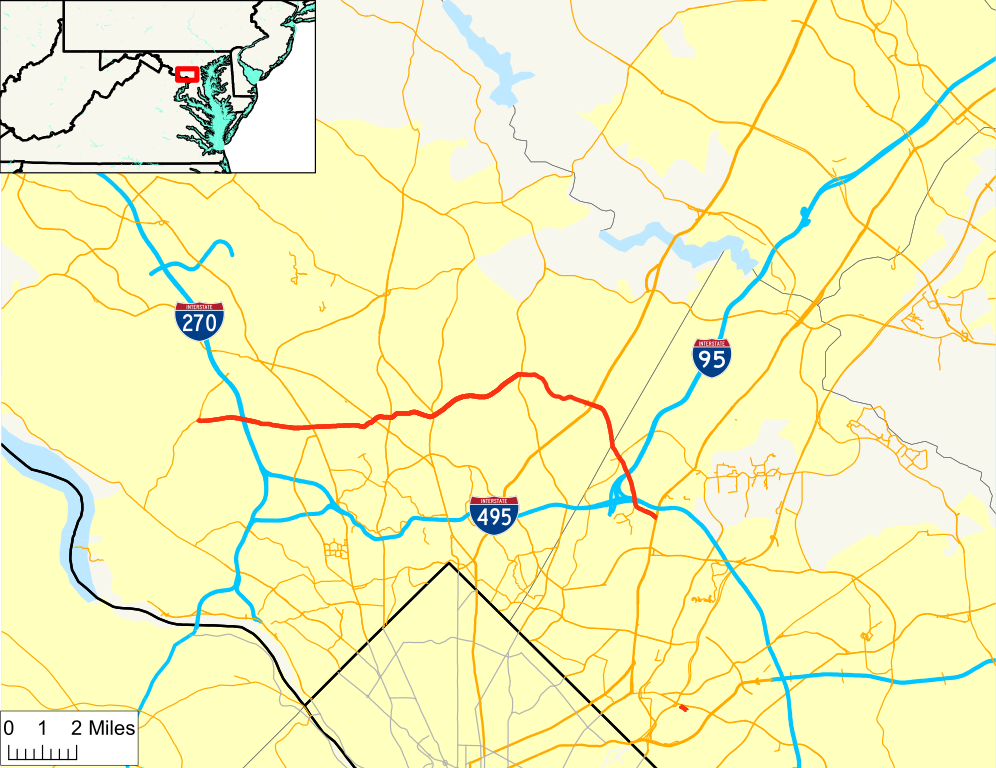
File:Randolph Road map.svg
Jump to navigation
Jump to search

Size of this PNG preview of this SVG file: 778 × 600 pixels. Other resolutions: 311 × 240 pixels | 623 × 480 pixels | 996 × 768 pixels | 1,280 × 987 pixels | 2,560 × 1,974 pixels | 991 × 764 pixels.
Original file (SVG file, nominally 991 × 764 pixels, file size: 2.38 MB)
File history
Click on a date/time to view the file as it appeared at that time.
| Date/Time | Thumbnail | Dimensions | User | Comment | |
|---|---|---|---|---|---|
| current | 00:50, 20 July 2009 | | 991 × 764 (2.38 MB) | commons>Algorerhythms | == Summary == {{Information |Description=Map of w:Randolph Road |Source=self-made |Date= |Author= Algorerhythms |Permission= |other_versions= }} Category:Maps of Maryland state highways == [[Commons:Copyright tags|Licensing] |
File usage
There are no pages that use this file.