File:R6 noto earthquake wajima street 2024-02-17 12.jpg
Jump to navigation
Jump to search

Size of this preview: 800 × 533 pixels. Other resolutions: 320 × 213 pixels | 640 × 427 pixels | 1,024 × 683 pixels | 1,280 × 853 pixels | 2,560 × 1,707 pixels | 3,648 × 2,432 pixels.
Original file (3,648 × 2,432 pixels, file size: 4.46 MB, MIME type: image/jpeg)
Summary
| Description |
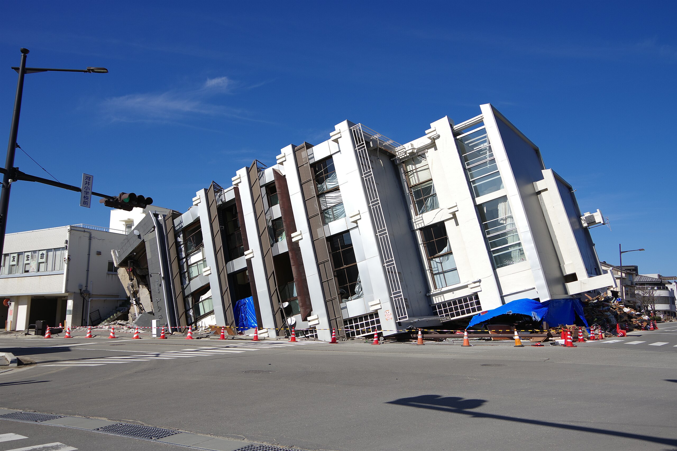
English: A view of the urban area of Wajima City, Ishikawa Prefecture, which was damaged by the 2024 Noto Peninsula Earthquake. Photographed on February 17, 2024.
日本語: 令和6年能登半島地震の被害を受けた石川県輪島市の市街地の様子。2024年2月17日撮影。 |
| Date | |
| Source | Own work |
| Author | Hurohukidaikon |
| Camera location | | View this and other nearby images on: OpenStreetMap |
|---|
Licensing
I, the copyright holder of this work, hereby publish it under the following license:
This file is licensed under the Creative Commons Attribution 4.0 International license.
- You are free:
- to share – to copy, distribute and transmit the work
- to remix – to adapt the work
- Under the following conditions:
- attribution – You must give appropriate credit, provide a link to the license, and indicate if changes were made. You may do so in any reasonable manner, but not in any way that suggests the licensor endorses you or your use.
File history
Click on a date/time to view the file as it appeared at that time.
| Date/Time | Thumbnail | Dimensions | User | Comment | |
|---|---|---|---|---|---|
| current | 14:17, 6 May 2024 | | 3,648 × 2,432 (4.46 MB) | commons>Hurohukidaikon | Uploaded own work with UploadWizard |
File usage
There are no pages that use this file.