File:Pyrenees topographic map-en.svg
Jump to navigation
Jump to search

Size of this PNG preview of this SVG file: 800 × 475 pixels. Other resolutions: 320 × 190 pixels | 640 × 380 pixels | 1,024 × 608 pixels | 1,280 × 760 pixels | 2,560 × 1,520 pixels | 3,200 × 1,900 pixels.
Original file (SVG file, nominally 3,200 × 1,900 pixels, file size: 6.3 MB)
File history
Click on a date/time to view the file as it appeared at that time.
| Date/Time | Thumbnail | Dimensions | User | Comment | |
|---|---|---|---|---|---|
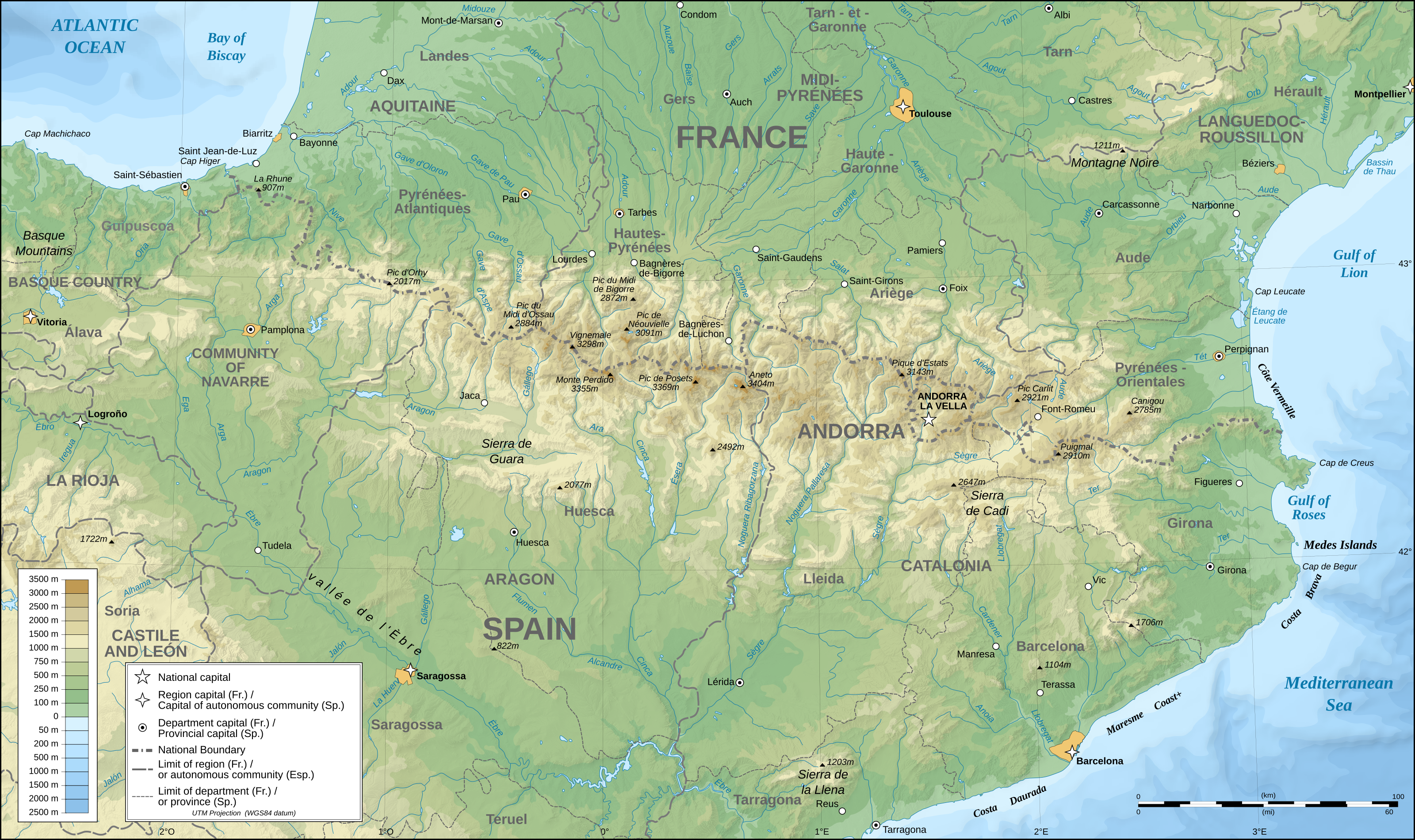
| current | 00:25, 28 May 2011 | | 3,200 × 1,900 (6.3 MB) | commons>RedWolf | {{Information |Description={{en|Topographic map in English of the Pyrenees mountains.<br/>''Note:'' The shaded relief is a raster image embedded in the SVG file.}} {{fr|Carte topographique des Pyrénées en english.<br/ |
File usage
There are no pages that use this file.