File:Puertoprincesa chart4343 1904.jpeg
Jump to navigation
Jump to search
Size of this preview: 715 × 600 pixels. Other resolutions: 286 × 240 pixels | 572 × 480 pixels | 916 × 768 pixels | 1,221 × 1,024 pixels | 2,442 × 2,048 pixels | 3,053 × 2,561 pixels.
Original file (3,053 × 2,561 pixels, file size: 1.31 MB, MIME type: image/jpeg)
File history
Click on a date/time to view the file as it appeared at that time.
| Date/Time | Thumbnail | Dimensions | User | Comment | |
|---|---|---|---|---|---|
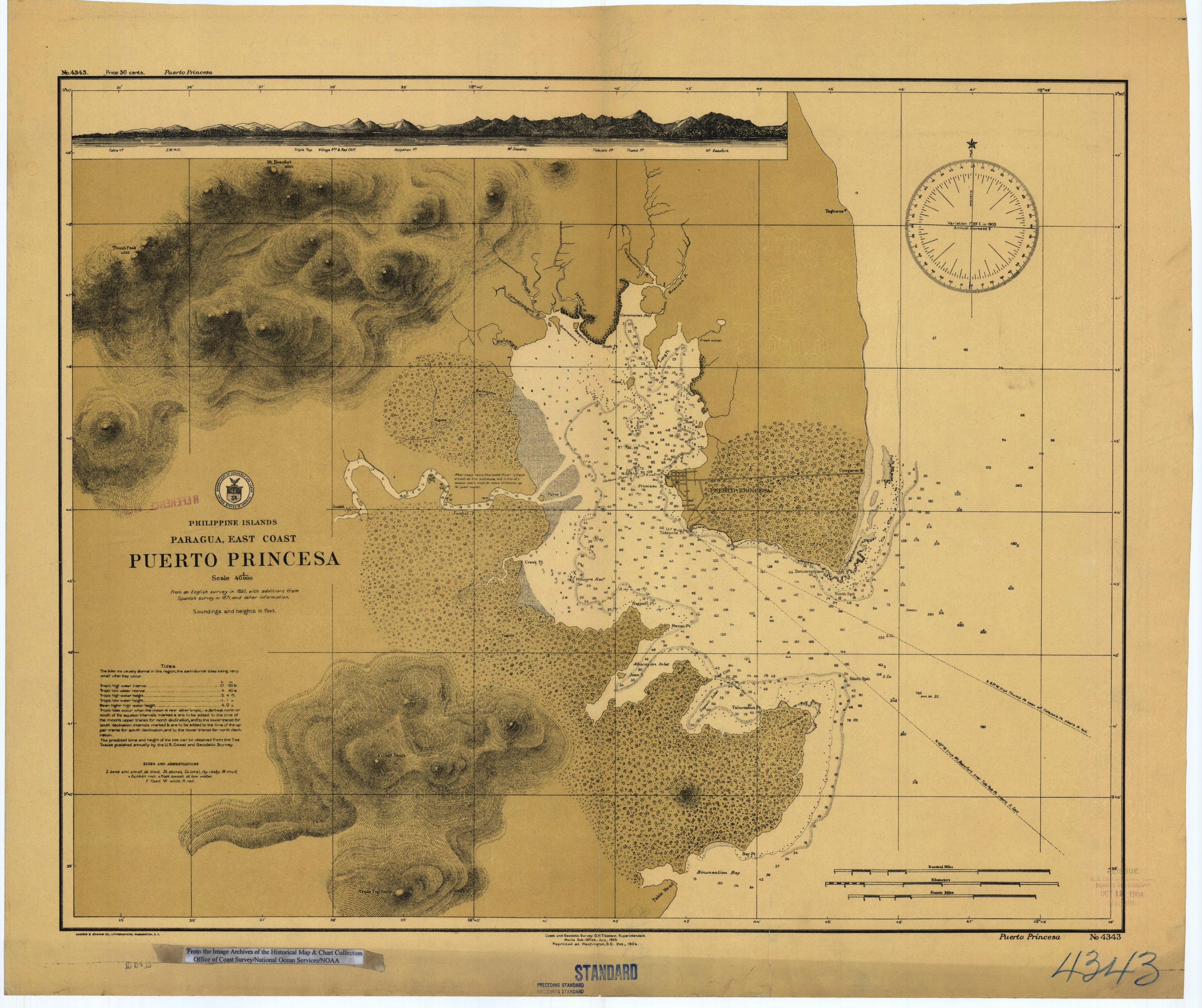
| current | 01:41, 17 March 2006 | | 3,053 × 2,561 (1.31 MB) | commons>Cdc~commonswiki | Scanned image of US Coast & Geodetic Survey (Manila Office) nautical chart #4343 Puerto Princesa, (Paragua), Palawan, Philippines, 1904. From the Image Archives of the [http://chartmaker.ncd.noaa.gov/csdl/ctp/abstract.htm Historical Map & Chart Collecti |
File usage
There are no pages that use this file.