File:PlanoMontevideo1867.jpg
Jump to navigation
Jump to search

Size of this preview: 800 × 564 pixels. Other resolutions: 320 × 226 pixels | 640 × 451 pixels | 1,024 × 722 pixels | 1,280 × 902 pixels | 1,969 × 1,388 pixels.
Original file (1,969 × 1,388 pixels, file size: 576 KB, MIME type: image/jpeg)
File history
Click on a date/time to view the file as it appeared at that time.
| Date/Time | Thumbnail | Dimensions | User | Comment | |
|---|---|---|---|---|---|
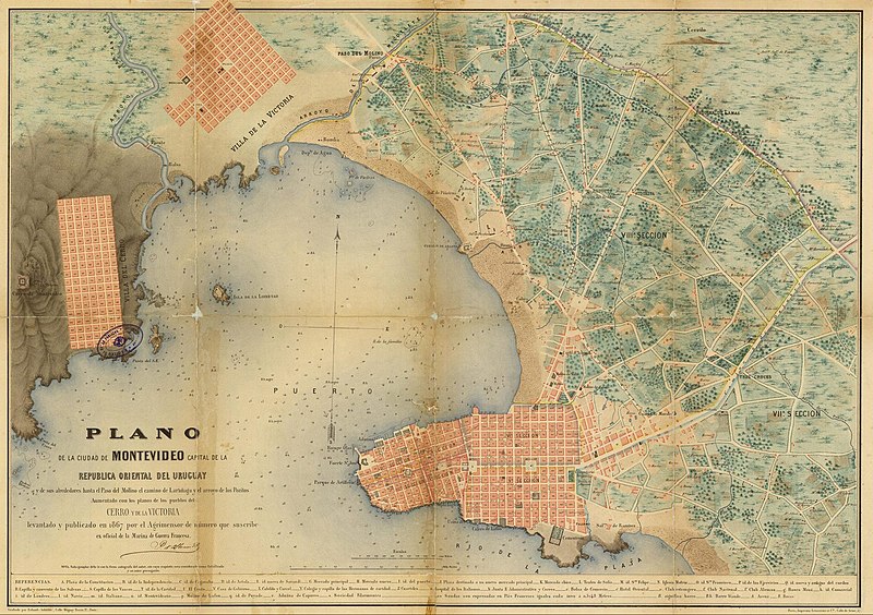
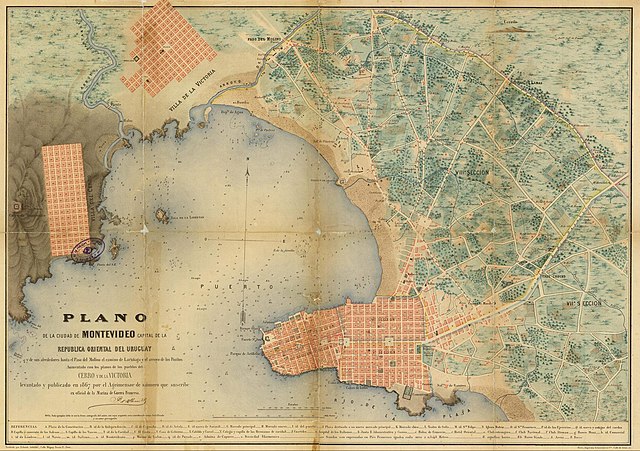
| current | 14:31, 2 August 2008 | | 1,969 × 1,388 (576 KB) | commons>Uruguayo-92 | {{Information |Description={{en|1=Map of the City of Montevideo and old towns (today neighborhoods) of Villa del Cerro and Pueblo Victoria, disegned in 1867 by the French surveyor I. D'Albenne.}} {{es|1=Plano de la Ciudad de Montevideo y los antiguos pueb |
File usage
There are no pages that use this file.