File:Plan ft st philip.jpg
Jump to navigation
Jump to search
Size of this preview: 530 × 600 pixels. Other resolutions: 212 × 240 pixels | 600 × 679 pixels.
Original file (600 × 679 pixels, file size: 75 KB, MIME type: image/jpeg)
File history
Click on a date/time to view the file as it appeared at that time.
| Date/Time | Thumbnail | Dimensions | User | Comment | |
|---|---|---|---|---|---|
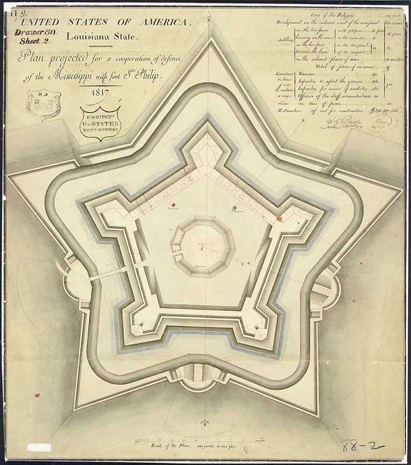
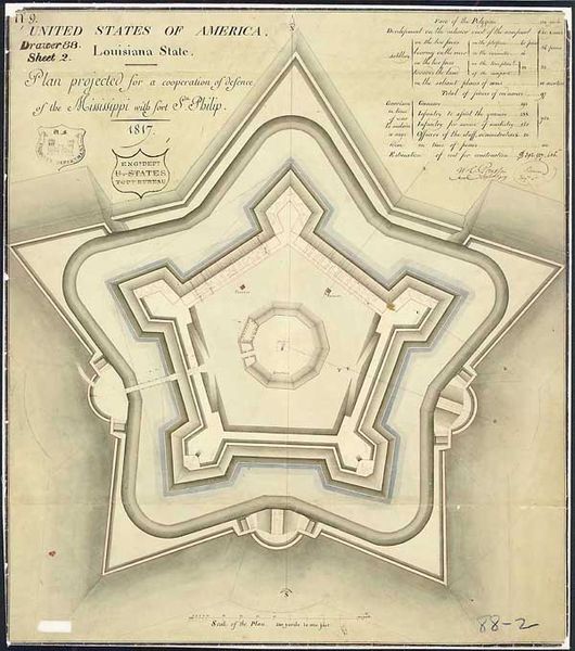
| current | 23:48, 28 March 2007 | | 600 × 679 (75 KB) | commons>Infrogmation | "Plan Projected for a Cooperation of Defense of the Mississippi with Ft. St. Philip" Drawn by cartographer and draftsman Guillaume Tell Poussin, 1817 Ink and wash on paper This planned fort, to work in cooperation with the existing colonial era Fort S |
File usage
There are no pages that use this file.