File:PassaicRiverNorthBend.png
Jump to navigation
Jump to search
Size of this preview: 401 × 599 pixels. Other resolutions: 161 × 240 pixels | 474 × 708 pixels.
Original file (474 × 708 pixels, file size: 101 KB, MIME type: image/png)
File history
Click on a date/time to view the file as it appeared at that time.
| Date/Time | Thumbnail | Dimensions | User | Comment | |
|---|---|---|---|---|---|
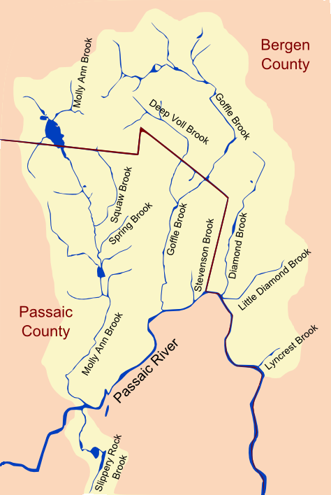
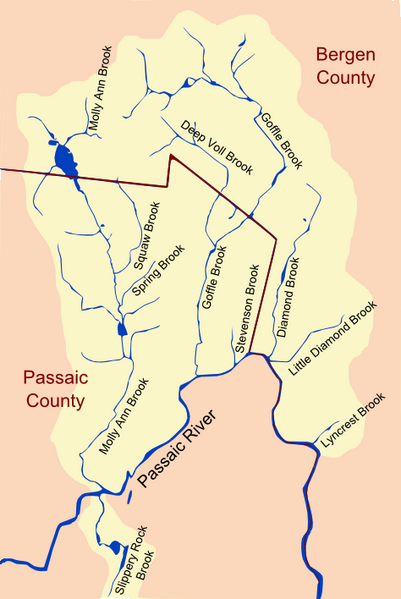
| current | 04:15, 4 February 2009 | | 474 × 708 (101 KB) | commons>Lithium6ion | -Major Tributaries of the North Bend of the Passaic River- (Image Width ~4.25 mi) From west to east: Slippery Rock Brook, Molly Ann Brook, Squaw Brook, Deep Voll Brook, Goffle Brook, Diamond Brook, Little Diamond Brook, and [[L |
File usage
There are no pages that use this file.