File:Oregon volcanoes map.gif
Jump to navigation
Jump to search

Size of this preview: 800 × 588 pixels. Other resolutions: 320 × 235 pixels | 640 × 470 pixels | 906 × 666 pixels.
Original file (906 × 666 pixels, file size: 16 KB, MIME type: image/gif, 0.1 s)
File history
Click on a date/time to view the file as it appeared at that time.
| Date/Time | Thumbnail | Dimensions | User | Comment | |
|---|---|---|---|---|---|
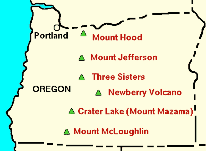
| current | 19:55, 21 September 2023 | | 906 × 666 (16 KB) | commons>Hike395 | == {{int:filedesc}} == {{Information |Description={{en|1=Cropped version of USGS Cascades volcanoes map, showing just the major volcanoes in Oregon}} |Source={{Derived from|Oregon volcanoes map.png|display=50}} |Date=2023-09-21 19:54 (UTC) |Author=* File:Oregon volcanoes map.png: Original file by Lyn Topinka, USGS. * cropping, AI upscaling: [[User:{{subst:REVISIONUSER}}|{{subst:REVISIONUSER}}]] |Permission= |other_versions= }} == {{int:license-header}} == {... |
File usage
There are no pages that use this file.