File:Operational Navigation Chart D-12, 6th edition.jpg
Jump to navigation
Jump to search

Size of this preview: 800 × 579 pixels. Other resolutions: 320 × 232 pixels | 640 × 463 pixels | 1,024 × 741 pixels | 1,280 × 926 pixels | 2,560 × 1,853 pixels | 9,254 × 6,698 pixels.
Original file (9,254 × 6,698 pixels, file size: 23 MB, MIME type: image/jpeg)
File history
Click on a date/time to view the file as it appeared at that time.
| Date/Time | Thumbnail | Dimensions | User | Comment | |
|---|---|---|---|---|---|
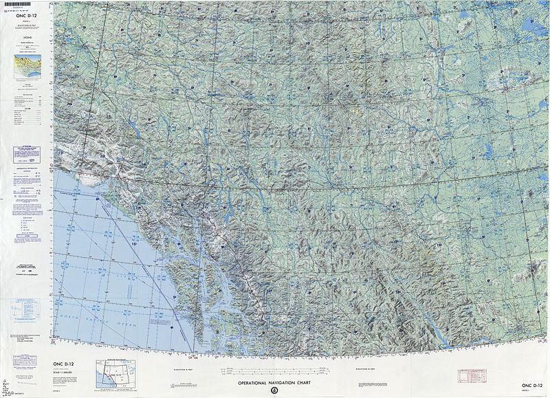
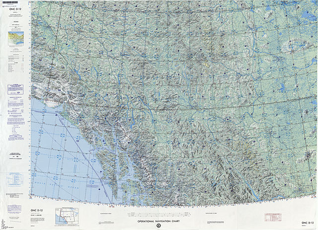
| current | 07:37, 13 September 2014 | | 9,254 × 6,698 (23 MB) | commons>Revent | == {{int:filedesc}} == {{Information |description={{en|1:1,000,000 scale Operational Navigation Chart, Sheet D-12, 6th edition. * Covers Alaska, Canada. * Lambert Conformal Conic Projection. ** Standard Parallels 57 20N and 62 40N. }} |date=1990-04 |so... |
File usage
There are no pages that use this file.