File:OpenStreetMap Belize.svg
Jump to navigation
Jump to search

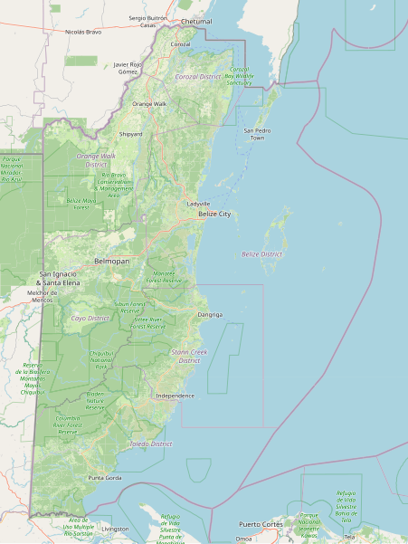
Size of this PNG preview of this SVG file: 451 × 600 pixels. Other resolutions: 180 × 240 pixels | 361 × 480 pixels | 577 × 768 pixels | 770 × 1,024 pixels | 1,539 × 2,048 pixels | 899 × 1,196 pixels.
Original file (SVG file, nominally 899 × 1,196 pixels, file size: 17.41 MB)
File history
Click on a date/time to view the file as it appeared at that time.
| Date/Time | Thumbnail | Dimensions | User | Comment | |
|---|---|---|---|---|---|
| current | 04:07, 3 September 2023 | | 899 × 1,196 (17.41 MB) | commons>CactiStaccingCrane | {{OpenStreetMap |name = OpenStreetMap Belize map |location = Belize |description = Map of Belize's landcover, major cities, protected areas, etc. Scale 1:1250000. |top = 18.625424540701264 |bottom = 15.749962572748768 |left = -89.39025878906251 |right = -87.12707519531251 |date = 3 September 2023 |authors = Dedicated to Charlie Plett, who did the impossible and mapped most of Belize's landuse. |other_versions... |
File usage
There are no pages that use this file.