File:Ontario Manitoba Boundaries (1915).jpg
Jump to navigation
Jump to search

Size of this preview: 402 × 600 pixels. Other resolutions: 161 × 240 pixels | 321 × 480 pixels | 514 × 768 pixels | 686 × 1,024 pixels | 1,372 × 2,048 pixels | 3,408 × 5,086 pixels.
Original file (3,408 × 5,086 pixels, file size: 6.2 MB, MIME type: image/jpeg)
.jpg)
File history
Click on a date/time to view the file as it appeared at that time.
| Date/Time | Thumbnail | Dimensions | User | Comment | |
|---|---|---|---|---|---|
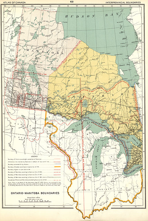
| current | 21:41, 9 March 2014 | | 3,408 × 5,086 (6.2 MB) | commons>Geo Swan | {{Information |Description=Chalifour, J. E. Ontario Manitoba Boundaries [map]. 1:6,336,000. In: Dept. of the Interior. Atlas of Canada Revised and Enlarged Edition. [Ottawa]: Dept. of the Interior, 1915, p.62. This map shows the complicated stages th... |
File usage
There are no pages that use this file.
.jpg)