File:Old map 1807 plan.jpg
Jump to navigation
Jump to search
Size of this preview: 505 × 600 pixels. Other resolutions: 202 × 240 pixels | 404 × 480 pixels | 1,004 × 1,192 pixels.
Original file (1,004 × 1,192 pixels, file size: 519 KB, MIME type: image/jpeg)
Summary
| Description |
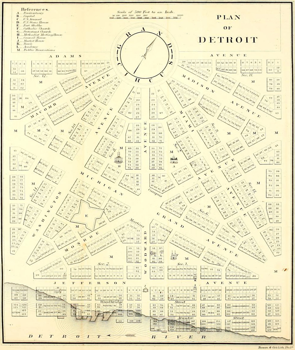
English: Detroit city layout plan circa 1807—following the 1805 fire that destroyed most of the city. The map shows Grand Circus Park (top), and some of the present-day Grand Circus Park Historic District. |
| Date | circa 1807 |
| Source | Dickens, Asbury & Forney, John W., eds. (1832) "Plan of Detroit" (Map). American State Papers. Vol. 6: Public Lands. 1:6,000. Washington, DC: Gales & Seaton. p. 299. OCLC 2053058. OL7014594M. LCCN 09033892. – via Archive.org. |
| Author | Unknown author |
Licensing
This image is in the public domain because it is a mere mechanical scan or photocopy of a public domain original, or – from the available evidence – is so similar to such a scan or photocopy that no copyright protection can be expected to arise. The original itself is in the public domain for the following reason:
This tag is designed for use where there may be a need to assert that any enhancements (eg brightness, contrast, colour-matching, sharpening) are in themselves insufficiently creative to generate a new copyright. It can be used where it is unknown whether any enhancements have been made, as well as when the enhancements are clear but insufficient. For known raw unenhanced scans you can use an appropriate {{PD-old}} tag instead. For usage, see Commons:When to use the PD-scan tag.  |


File history
Click on a date/time to view the file as it appeared at that time.
| Date/Time | Thumbnail | Dimensions | User | Comment | |
|---|---|---|---|---|---|
| current | 05:18, 4 April 2013 | | 1,004 × 1,192 (519 KB) | commons>Imzadi1979 | perspective correction and cropped to remove whitespace |
File usage
There are no pages that use this file.