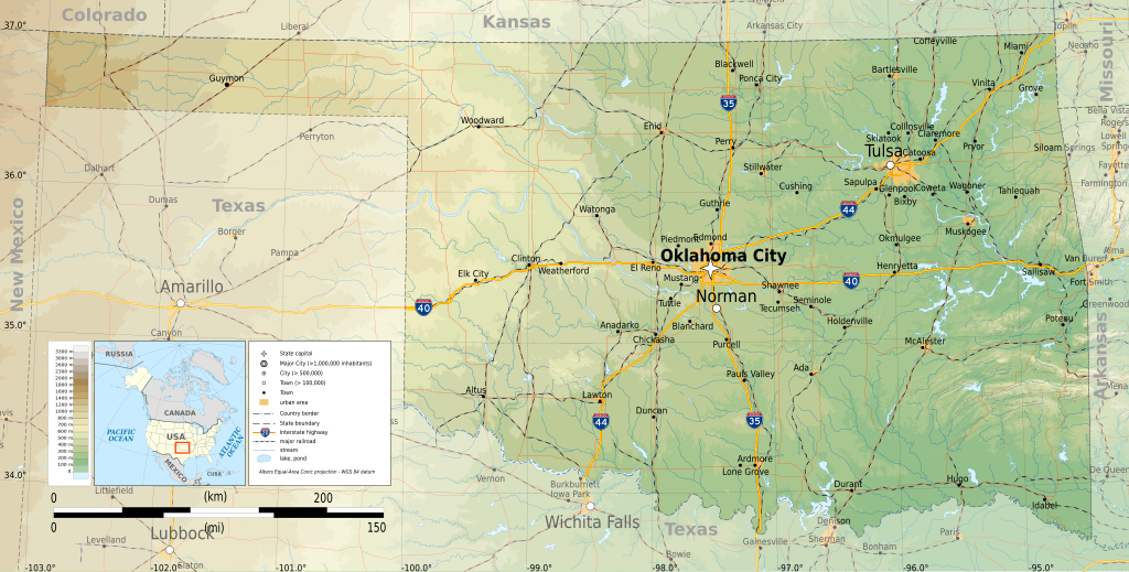
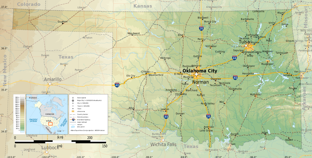
File:Oklahoma topographic map-en.svg
Jump to navigation
Jump to search

Size of this PNG preview of this SVG file: 800 × 405 pixels. Other resolutions: 320 × 162 pixels | 640 × 324 pixels | 1,024 × 518 pixels | 1,280 × 648 pixels | 2,560 × 1,296 pixels | 3,952 × 2,000 pixels.
Original file (SVG file, nominally 3,952 × 2,000 pixels, file size: 14.9 MB)
File history
Click on a date/time to view the file as it appeared at that time.
| Date/Time | Thumbnail | Dimensions | User | Comment | |
|---|---|---|---|---|---|
| current | 23:31, 9 March 2015 | | 3,952 × 2,000 (14.9 MB) | commons>Ikonact | =={{int:filedesc}}== {{Information |description={{en|1=Topographic map of en:Oklahoma}} Albers Equal-Area Conic projection, WGS84 datum Geographic limits of the map: *West: 103.2° W *East: 94.2° W *North: 37.2° N *South: 33.4° N |date=2015-03... |
File usage
There are no pages that use this file.