File:Niger ag land use map USGS.png
Jump to navigation
Jump to search
No higher resolution available.
Niger_ag_land_use_map_USGS.png (800 × 267 pixels, file size: 131 KB, MIME type: image/png)
File history
Click on a date/time to view the file as it appeared at that time.
| Date/Time | Thumbnail | Dimensions | User | Comment | |
|---|---|---|---|---|---|
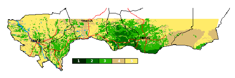
| current | 17:13, 26 February 2009 | 800 × 267 (131 KB) | commons>T L Miles | {{Information |Description={{en|1=Niger, Cropland Use Indicator, drawn from Normalized Difference Vegetation Index (NDVI) data, for period 1986-1988. Scale is: 1= 70% - 100% Crop coverage 2= 50% - 70% Crop coverage 3= 30% - 50% Crop coverage 4= 5% - 30% C |
File usage
There are no pages that use this file.