File:New orleans plan 1728.jpg
Jump to navigation
Jump to search

Size of this preview: 724 × 599 pixels. Other resolutions: 290 × 240 pixels | 580 × 480 pixels | 928 × 768 pixels | 1,237 × 1,024 pixels | 1,723 × 1,426 pixels.
Original file (1,723 × 1,426 pixels, file size: 678 KB, MIME type: image/jpeg)
File history
Click on a date/time to view the file as it appeared at that time.
| Date/Time | Thumbnail | Dimensions | User | Comment | |
|---|---|---|---|---|---|
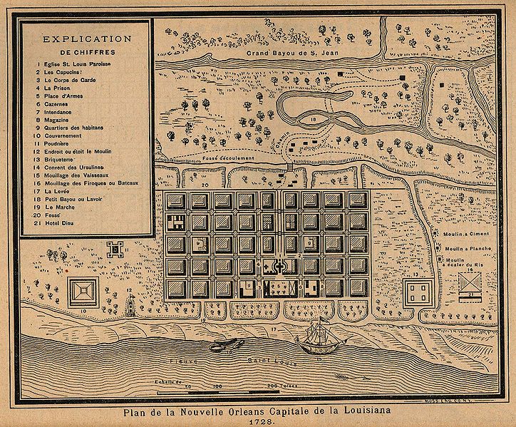
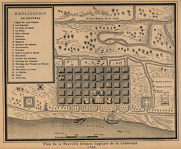
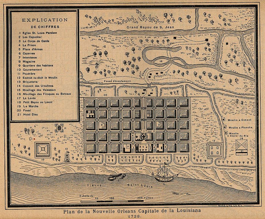
| current | 06:04, 6 May 2006 | | 1,723 × 1,426 (678 KB) | commons>Infrogmation | Map of New Orleans, 1728 "Plan de la Nouvelle Orleans Capitale de la Louisiana 1728." From Report on the Social Statistics of Cities, Compiled by George E. Waring, Jr., United States. Census Office, Part II, 1886 copyright expired. [[Category:Maps of N |
File usage
There are no pages that use this file.