File:Nashcivilwarmap.jpg
Jump to navigation
Jump to search

Size of this preview: 590 × 599 pixels. Other resolutions: 236 × 240 pixels | 473 × 480 pixels | 756 × 768 pixels | 1,008 × 1,024 pixels | 1,400 × 1,422 pixels.
Original file (1,400 × 1,422 pixels, file size: 300 KB, MIME type: image/jpeg)
File history
Click on a date/time to view the file as it appeared at that time.
| Date/Time | Thumbnail | Dimensions | User | Comment | |
|---|---|---|---|---|---|
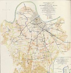
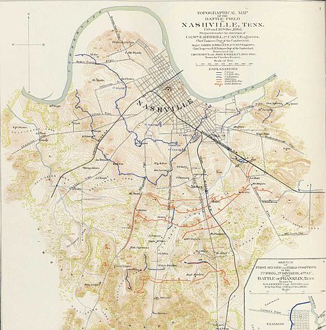
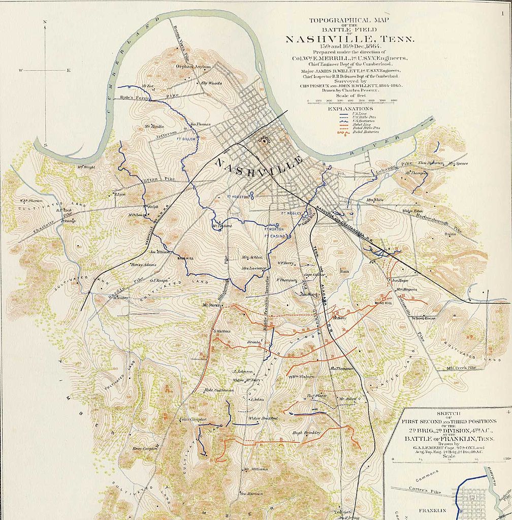
| current | 23:15, 5 June 2009 | | 1,400 × 1,422 (300 KB) | commons>Kaldari | {{Information |Description=Topographical map of Nashville and surrounding area made during the American Civil War. Drawn by Charles Peseux under the direction of Col. William E. Merrill, Chief Engineer, Department of the Cumbe |
File usage
There are no pages that use this file.