File:NYCS Maps IRT 1904.jpg
Jump to navigation
Jump to search

Size of this preview: 800 × 336 pixels. Other resolutions: 320 × 134 pixels | 640 × 269 pixels | 1,024 × 430 pixels | 1,280 × 537 pixels | 3,042 × 1,277 pixels.
Original file (3,042 × 1,277 pixels, file size: 1.06 MB, MIME type: image/jpeg)
File history
Click on a date/time to view the file as it appeared at that time.
| Date/Time | Thumbnail | Dimensions | User | Comment | |
|---|---|---|---|---|---|
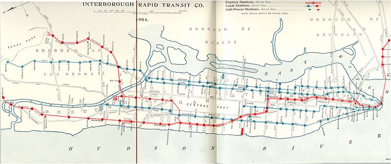
| current | 16:46, 15 February 2007 | | 3,042 × 1,277 (1.06 MB) | commons>Johnny S. | {{Information |Description= {{de|Streckennetz der Interborough Rapid Transit Corporation nach Vertrag eins und zwei ''(Contract No. 1 and No. 2)''.<br />Die Manhattaner Hochbahnen sind blau, die neue U-Bahn rot eingezeichnet.}} {{en|Line map of |
File usage
There are no pages that use this file.