File:NPS american-samoa-map.jpg
Jump to navigation
Jump to search
Size of this preview: 800 × 547 pixels. Other resolutions: 320 × 219 pixels | 640 × 438 pixels | 1,024 × 700 pixels | 1,280 × 875 pixels | 1,502 × 1,027 pixels.
Original file (1,502 × 1,027 pixels, file size: 237 KB, MIME type: image/jpeg)
File history
Click on a date/time to view the file as it appeared at that time.
| Date/Time | Thumbnail | Dimensions | User | Comment | |
|---|---|---|---|---|---|
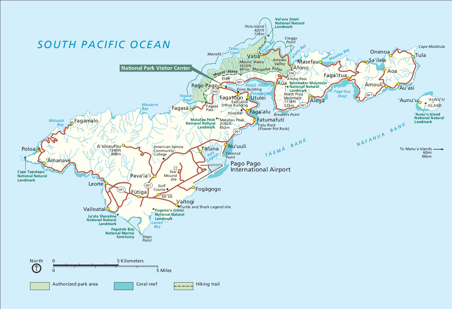
| current | 06:33, 12 May 2017 | | 1,502 × 1,027 (237 KB) | commons>RKBot | =={{int:filedesc}}== {{Information |description= {{en|1=Main American Samoa map showing the park lands on Tutuila Island around Pago Pago.}} |date= 2016-02-22 |source= U.S. National Park Service (http://npmaps.com/wp-content/uploads/american-samoa-map.... |
File usage
There are no pages that use this file.