File:NPS UnifiedRegionsMap2020.png
Jump to navigation
Jump to search

Size of this preview: 800 × 549 pixels. Other resolutions: 320 × 220 pixels | 640 × 439 pixels | 1,024 × 703 pixels | 1,280 × 879 pixels | 2,560 × 1,758 pixels | 8,516 × 5,848 pixels.
Original file (8,516 × 5,848 pixels, file size: 15.96 MB, MIME type: image/png)
Summary
| Description |
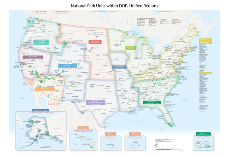
English: A map of the National Park Units within each of the Department of the Interior's Unified Regions |
| Date | |
| Source | https://www.nps.gov/media/photo/collection-item.htm?pg=7347320&cid=305fb7af-a71b-469b-941e-a98b439c882f&id=3b65f32a-30fc-407f-b634-13c5e31ff4b3&sid=56d5810041ef49bf9e0157f2c8fb441b&p=1&sort=relevance |
| Author | National Park Service |
Licensing
| This image or media file contains material based on a work of a National Park Service employee, created as part of that person's official duties. As a work of the U.S. federal government, such work is in the public domain in the United States. See the NPS website and NPS copyright policy for more information. |
File history
Click on a date/time to view the file as it appeared at that time.
| Date/Time | Thumbnail | Dimensions | User | Comment | |
|---|---|---|---|---|---|
| current | 19:06, 25 March 2023 | | 8,516 × 5,848 (15.96 MB) | commons>Ranicher | Zoomed in a little |
File usage
There are no pages that use this file.