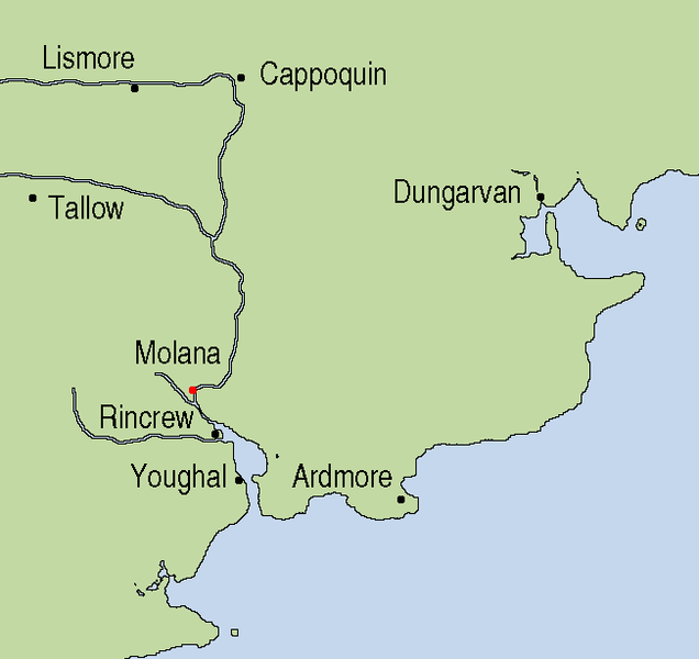
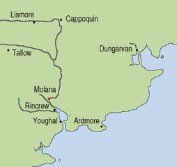
File:Molana Priory Map.png
Jump to navigation
Jump to search

Size of this preview: 636 × 600 pixels. Other resolutions: 254 × 240 pixels | 509 × 480 pixels | 651 × 614 pixels.
Original file (651 × 614 pixels, file size: 13 KB, MIME type: image/png)
File history
Click on a date/time to view the file as it appeared at that time.
| Date/Time | Thumbnail | Dimensions | User | Comment | |
|---|---|---|---|---|---|
| current | 21:52, 17 October 2007 | | 651 × 614 (13 KB) | commons>AFBorchert | {{Information |Description=Map of the surrounding area of Molana Priory, County Waterford, Ireland |Source=This map is based on Image:Topography Ireland.jpg and my own work using Gimp and xfig. |Date=17 October 2007 |Author=[[User:AFBorchert|AFBorcher |
File usage
There are no pages that use this file.