File:Mithila Map.jpg
Jump to navigation
Jump to search

Size of this preview: 657 × 600 pixels. Other resolutions: 263 × 240 pixels | 526 × 480 pixels | 983 × 897 pixels.
Original file (983 × 897 pixels, file size: 248 KB, MIME type: image/jpeg)
File history
Click on a date/time to view the file as it appeared at that time.
| Date/Time | Thumbnail | Dimensions | User | Comment | |
|---|---|---|---|---|---|
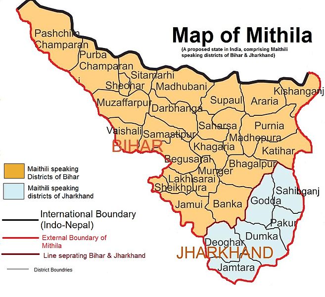
| current | 17:22, 25 April 2012 | | 983 × 897 (248 KB) | commons>Vikas11004315 | {{subst:Upload marker added by en.wp UW}} {{Information |Description = {{en|Map showing Maithili speaking region of India which is proposed for Mithila State. I covers 24 districts of Bihar and 6 districts of Jharkhand}} |Source = It is created using M... |
File usage
There are no pages that use this file.