File:Missouri, Kansas and Texas Railway system map (1918).svg
Jump to navigation
Jump to search

Size of this PNG preview of this SVG file: 800 × 457 pixels. Other resolutions: 320 × 183 pixels | 640 × 366 pixels | 1,024 × 585 pixels | 1,280 × 731 pixels | 2,560 × 1,463 pixels | 1,120 × 640 pixels.
Original file (SVG file, nominally 1,120 × 640 pixels, file size: 328 KB)
.svg)
File history
Click on a date/time to view the file as it appeared at that time.
| Date/Time | Thumbnail | Dimensions | User | Comment | |
|---|---|---|---|---|---|
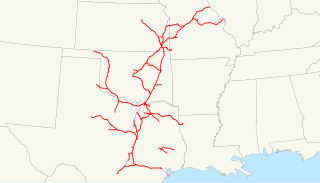
| current | 23:19, 1 October 2008 | | 1,120 × 640 (328 KB) | commons>NE2 | == Summary == This is a map of the Missouri, Kansas and Texas Railway (Katy) as of 1918, with trackage rights in purple and then-proposed lines dotted. Email me if you would like a copy of the GIS data I cr |
File usage
There are no pages that use this file.
.svg)