File:Mississippi Locator Map (Pine Belt Region).png
Jump to navigation
Jump to search
No higher resolution available.
Mississippi_Locator_Map_(Pine_Belt_Region).png (224 × 349 pixels, file size: 7 KB, MIME type: image/png)
.png)
File history
Click on a date/time to view the file as it appeared at that time.
| Date/Time | Thumbnail | Dimensions | User | Comment | |
|---|---|---|---|---|---|
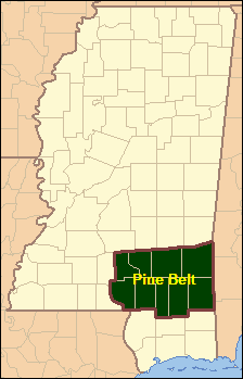
| current | 18:49, 18 July 2021 | | 224 × 349 (7 KB) | commons>Woodlot | {{Information |Description= {{en|1=Locator Map of Mississippi, United States. Added Pine Belt Region.}} |Source={{Derived from|Mississippi_Locator_Map.PNG|display=50}} |Date=2021-07-18 |Author= *Mississippi_Locator_Map.PNG: US Census, User:Ruhrfisch *derivative work: User:Woodlot |Permission= |other_versions= }} Category:Maps of Mississippi (state) Category:Geography of Mississippi (state) |
File usage
There are no pages that use this file.
.png)