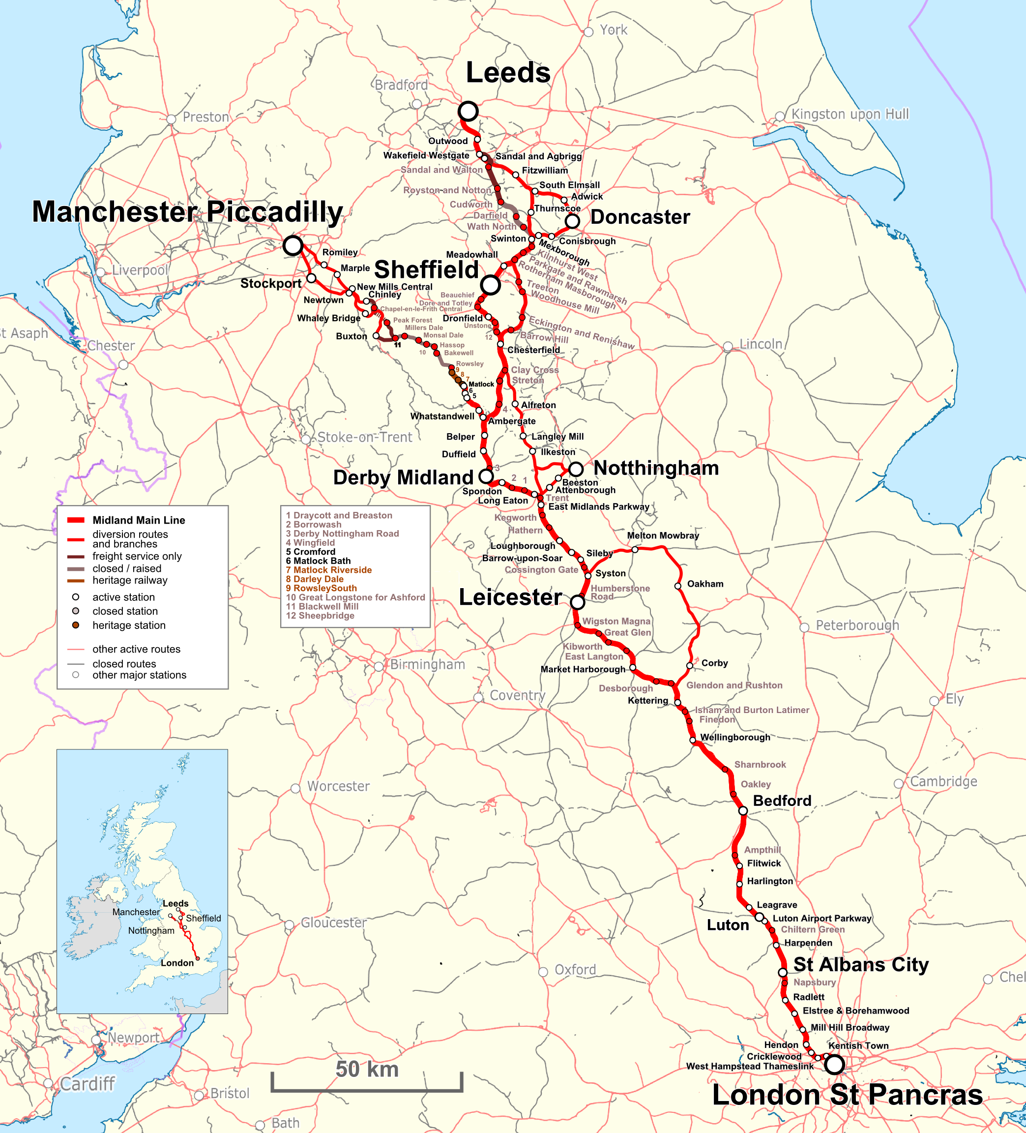
File:Midland Main Line Map en.png
Jump to navigation
Jump to search
Size of this preview: 543 × 599 pixels. Other resolutions: 217 × 240 pixels | 435 × 480 pixels | 696 × 768 pixels | 928 × 1,024 pixels | 2,087 × 2,304 pixels.
Original file (2,087 × 2,304 pixels, file size: 1.9 MB, MIME type: image/png)
File history
Click on a date/time to view the file as it appeared at that time.
| Date/Time | Thumbnail | Dimensions | User | Comment | |
|---|---|---|---|---|---|
| current | 13:39, 28 May 2017 | | 2,087 × 2,304 (1.9 MB) | commons>Pechristener | {{Information |Description={{en|Map of the {{w|Midland Main Line}} in UK. Index in English}}{{de|Karte der {{w|Midland Main Line||de}} in UK. Legende Englisch}} |Source=Map was created by using * [http://www.openstreetmap.org/ Open Street Map] Data *... |
File usage
There are no pages that use this file.