File:Massachusetts wind resource map 50m 800.jpg
Jump to navigation
Jump to search
Size of this preview: 776 × 600 pixels. Other resolutions: 311 × 240 pixels | 621 × 480 pixels | 994 × 768 pixels | 1,100 × 850 pixels.
Original file (1,100 × 850 pixels, file size: 557 KB, MIME type: image/jpeg)
File history
Click on a date/time to view the file as it appeared at that time.
| Date/Time | Thumbnail | Dimensions | User | Comment | |
|---|---|---|---|---|---|
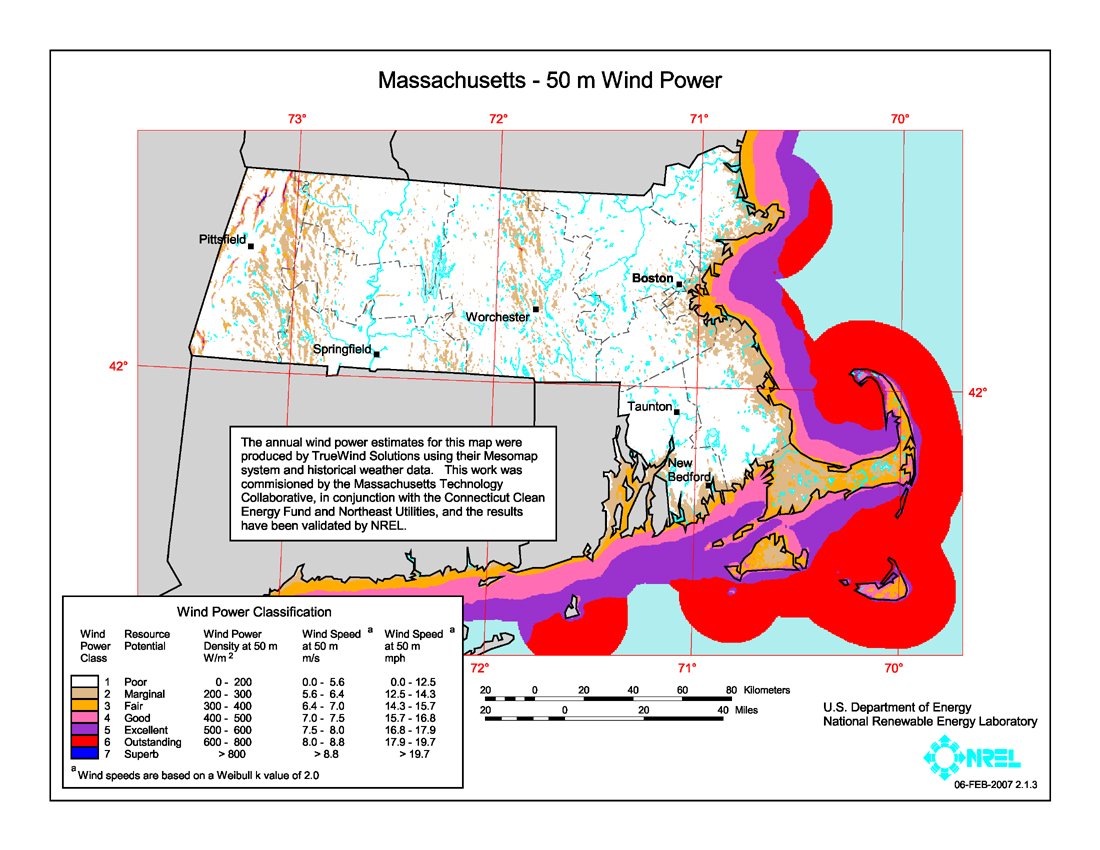
| current | 07:42, 26 January 2009 | | 1,100 × 850 (557 KB) | commons>Teratornis | == Summary == {{Information |Description={{en|1=Average annual wind power distribution for Massachusetts, 50m height above ground, also showing location of existing electrical transmission lines}} |Source=http://www.windpoweringamerica.gov/images/windmaps |
File usage
There are no pages that use this file.