File:Marden Henge map.png
Jump to navigation
Jump to search
No higher resolution available.
Marden_Henge_map.png (522 × 390 pixels, file size: 189 KB, MIME type: image/png)
File history
Click on a date/time to view the file as it appeared at that time.
| Date/Time | Thumbnail | Dimensions | User | Comment | |
|---|---|---|---|---|---|
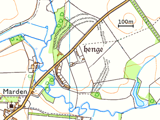
| current | 23:42, 15 March 2016 | | 522 × 390 (189 KB) | commons>Pasicles | {{Information |Description ={{en|1=Simplified map of the Marden Henge earthwork in Wiltshire, England. Based on Ordnance Survey maps, available under the [https://www.ordnancesurvey.co.uk/opendatadownload/products.html Ordnance Su... |
File usage
There are no pages that use this file.