File:Map of the Kiel Canal.png
Jump to navigation
Jump to search

Size of this preview: 773 × 600 pixels. Other resolutions: 310 × 240 pixels | 619 × 480 pixels | 990 × 768 pixels | 1,280 × 993 pixels | 1,814 × 1,407 pixels.
Original file (1,814 × 1,407 pixels, file size: 1.69 MB, MIME type: image/png)
File history
Click on a date/time to view the file as it appeared at that time.
| Date/Time | Thumbnail | Dimensions | User | Comment | |
|---|---|---|---|---|---|
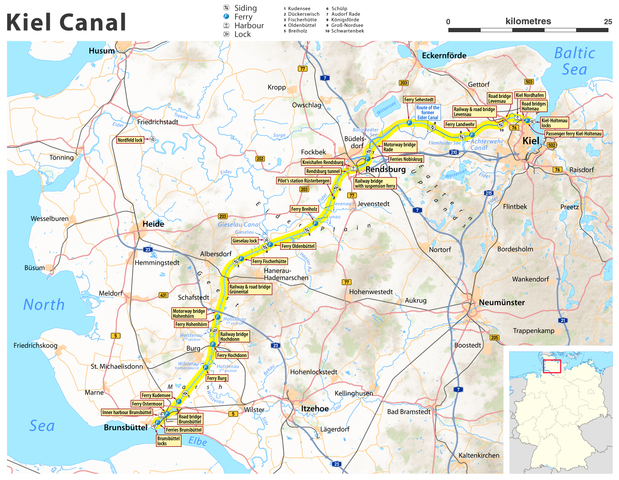
| current | 20:26, 14 September 2011 | | 1,814 × 1,407 (1.69 MB) | commons>Chumwa | {{Information |Description={{de|Karte des Nord-Ostsee-Kanals}} {{en|Map of the Kiel Canal}} |Author=Maximilian Dörrbecker (Chumwa) |Source=own work, using * OpenStreetMap data for the background * topographical |
File usage
There are no pages that use this file.