File:Map of salt domes in the gulf coastal plain.jpg
Jump to navigation
Jump to search
Size of this preview: 800 × 446 pixels. Other resolutions: 320 × 178 pixels | 640 × 357 pixels | 1,024 × 571 pixels | 1,280 × 713 pixels | 2,639 × 1,471 pixels.
Original file (2,639 × 1,471 pixels, file size: 684 KB, MIME type: image/jpeg)
File history
Click on a date/time to view the file as it appeared at that time.
| Date/Time | Thumbnail | Dimensions | User | Comment | |
|---|---|---|---|---|---|
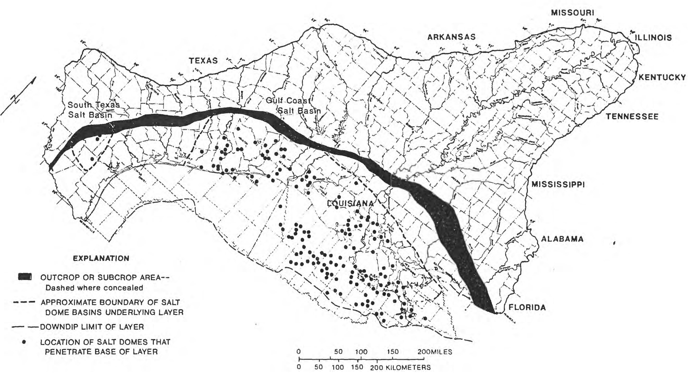
| current | 19:50, 26 July 2023 | | 2,639 × 1,471 (684 KB) | commons>Cosmia Nebula | Uploaded a work by By Jeffery D. Beckman and Alex K. Williamson U.S. GEOLOGICAL SURVEY WATER-RESOURCES INVESTIGATIONS REPORT 90-4060 A Contribution of the Regional Aquifer-Systems Analysis Program AUSTIN, TEXAS 1990 from SALT-DOME LOCATIONS IN THE GULF COASTAL PLAIN, SOUTH-CENTRAL UNITED STATES Figure 4. Location of salt domes that penetrate the base of layer 9 (permeable zone C). with UploadWizard |
File usage
There are no pages that use this file.